Sunday, May 31, 2009

This Week in the Natural Capital: June 1-7

Each week, we will list opportunities to get outdoors, to learn about nature, and to do service. We'll list just brief teasers about each one. Please click through to the organization hosting each event for more details. Some events require prior registration; some charge a fee.

This week's highlight: National Trails Day is Saturday, June 6. Get out and celebrate the effort of all the people who work long, hard hours keeping up the trails that we all enjoy -- or pitch in yourself. The Sierra Club is celebrating with 5 hikes scheduled for the day. The Potomac Appalachian Trail Club will have activities based at Byrd Visitor Center in Shenandoah National Park as well as several opportunities for trail crew work, including one in Rock Creek Park. Several other groups are also sponsoring hikes.

Also
: Saturday is also the Chesapeake Bay Foundation's 20th annual Clean the Bay Day. "Litter pollutes our waterways, kills marine and other wildlife, and degrades our neighborhoods. Shoreline debris is one of the most visible and pervasive reminders that the Chesapeake Bay is in need of restoration and improved stewardship...Join 7,000 fellow Virginians in removing unhealthy debris from cherished waterways throughout the Commonwealth. Show the world that an unhealthy Bay is unacceptable!"

Sierra Club
Tue: Robertson Mt., White Oak Canyon, and Old Rag (16 mi)
Tue eve: Canoe & Kayak lessons at Fletcher's Boat House
Sat: Potomac Heritage Trail service trip
Sat: Bull Run Mountains Natural Area (7 mi, carpool from metro)
Sat: Meadowood and Pohick Bay on Mason Neck (10 mi, carpool from metro)
Sat: Seneca Creek State Park (8.8 mi)
Sat: Potomac Heritage Trail hike (15 mi, carpool from metro)
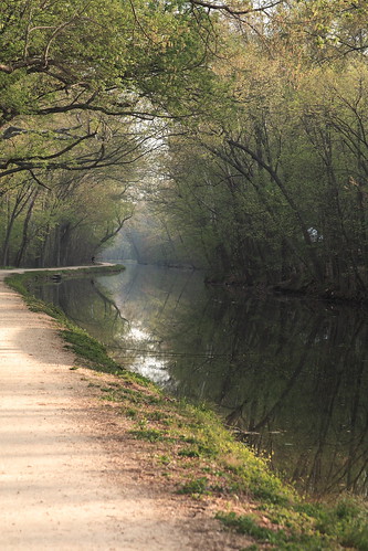
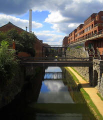
Sun: C&O Canal, Carderock to Great Falls, followed by picnic & music (up to 10 mi)
Sun: Rock Creek Park (7 mi)

Potomac Appalachian Trail Club
Many cabin and trail crew work trips.
Tue: Robinson Mtn, White Oak Canyon, and Old Rag (16 mi)
Wed: College Park Dairy and Lake Artemesia (5-6 mi, meets at metro)
Sat: National Trail Day at Shenandoah National Park, including
activities and several short hikes leaving from Byrd Visitor Center
Sun: SNP - Panorama to Elkwallow (5.5 or 9 mi, bus from metro)

Maryland Native Plant Society
Sun: Fort Dupont plant ID


Audubon Naturalist Society
Sat: Elliott Island on the Eastern Shore

Center Hiking Club
Tue eve: Vienna stroll (2-4 mi)
Wed eve: Lower NW Washington (4-5 mi)
Sat: Matthew Henson Trail (7 mi, meets at Twinbrook Metro)

Capital Hiking Club
Fri
eve: C&O Canal moonlight hike
Sat: Conestoga Trail, PA (7-8.7 mi, bus available)

Washington Women Outdoors
Sat: Piney Branch Day Hike (8 mi)

Northern Virginia Hiking Club
Sat: Dumbarton Oaks walk and poetry reading (3 mi)
Sat: Massanutten (11 mi)
Sun:Fraser Preserve in McLean (6 mi)

United States Botanical Garden
Mon eve: Tour of native plants in the National Garden

Rock Creek Park
Sun: Rolling Meadow Bridge hike (2.5 mi; ages 8+)

FOR KIDS


Rock Creek Park
Fri: Creature Feature (all ages)
Sat: Just "fur" fun (all ages)
Sun: Rolling Meadow Bridge hike (2.5 mi; ages 8+)

What did we miss? Add events in the comments section.

Friday, May 29, 2009

Want to See More? Use Your Ears.

What is your primary experience of a walk in nature? For most people, it is what you see: the greenery, the scenery, the occasional animal. That's all well and good, but if you really want to experience nature, don't depend just on your eyes. You'll see a lot more if you use other senses to help you know where to look.

In this post, we'll explore sound: how can your ears help you see animals you might otherwise miss as you're just walking down a trail?

Bird songs. Every bird species has its own distinctive set of songs and calls. It can be an overwhelming task to learn them. Start by just distinguishing among the songs. Some are high-pitched, some are lower. Some have lots of notes, some have just a few. Once you can tell them apart, pick a song and try to spot the bird that goes with it. If you make a connection between the visual and the sound, it's much easier to remember which bird makes which noises. As you learn them, you'll be better able to decide which ones are worth stopping for. That little brown bird? Maybe not. An indigo bunting? We'll stop every time.

Bird alarm calls. In addition to their normal song, most birds also have an alarm call. If you hear several birds in a concentrated area making insistent, repeated chirps, stop and check out what they're so upset about. Sometimes, you won't be able to figure it out. But we have seen many hawks this way, as well as owls, large rat snakes, and foxes.

Other animal alarms. Deer will generally freeze quietly when they first see you, giving you no aural cue to their presence. But if they feel more threatened, they'll snort before they run off -- usually giving you time to spot their white tails in flight. Beavers will let you know they're there as they slap the water with their tail before they duck under the water. If you sit quietly, they might come back up.

Rustling in the leaves. Usually it's just a squirrel. And sometimes a tiny insect can make a big rustle. But if you stop and look when you hear something, you can also be rewarded by something larger: snakes, toads, voles, and other ground-based critters.

Try some of these tricks:

Close your eyes. It's hard to get around the fact that vision is our dominant sense. So try this: stop, close your eyes, and just listen for a while. Try to separate out all the sounds. What do you hear? Is there water nearby? A road? An insect buzzing around your head? How many different birds can you hear?

Directional hearing. Many animals have big ears they can point in a certain direction to focus in on a sound. Our ears are a more all-purpose design. But you can mimic the parabolic dish of a dog's ears by cupping your a hand behind each ear and turning your head in the direction you want to focus in on. We do this naturally when we cup a hand behind an ear when we haven't heard someone.

Be quiet. If you are talking loudly with a friend, it will be harder to hear everything around you -- and many animals will run away from you entirely. We have some friends who have agreed to spend the first 10 minutes of every hike together in silence. It's a nice way to center yourself and be present. The rest of your hike will be better for it.

Do you have other ways you use your hearing to experience nature more fully? Experiences with these techniques? Post a comment.

Thursday, May 28, 2009

LOOK FOR: Mulberries

In early- to mid-June, you are likely to start noticing purple bird droppings everywhere. You will also see a select group of people in-the-know with telltale purple stains on their fingertips. The culprit: mulberries.

Morus rubra is a native tree related to the Asian mulberry trees (morus alba) used to raise silkworms. In fact, you'll find both growing in this area, because at some point there was an attempt to establish a silk industry on the East Coast. Rubra berries darken from white to red to a deep purple as they ripen. Alba berries remain white but get softer when ripe. Despite their different continents of origin, the two species are closely enough related that you may also see hybrid trees with fruits that are mixed colors or a lighter purple when ripe.

Both species of mulberries are edible, and they're hard to confuse with anything else: there aren't any other local trees bearing fruit that looks like this. The berries look like blackberries, but those grow on canes coming out of the ground, not on tree branches, and they won't come until later in the summer.

Mulberries can be used like other berries: they can be eaten raw or cooked into cobblers, pies, jams, or any other fruit recipe. The flavor of mulberries is much less tart than many other berries, so you may find you like them better with a little lemon juice or mixed with another fruit. As with many fruits, unripe berries can make you sick. You want berries that are soft, and dark purple.

One good way to spot a tree with ripe mulberries is that the fruit will start falling to the ground: if you see purple spots on the sidewalk or street, look up and you're likely to see fruit on the branches as well. This tendency of the fruit to fall when ripe leads to an easy way to harvest large quantities: put a tarp or a sheet on the ground and shake the branches over it. You'll have to sort through the assorted bits and pieces that fall down, but it's still much faster than picking individual berries.

In the wild: Actually, you're most likely to spot this tree in residential neighborhoods, especially along fences where birds have sat after eating mulberries. Most homeowners will be more than happy to have you take some of their berries before they fall on the ground and make a mess. There are some along the paved path in the Peirce Mill area of Rock Creek Park.

In your yard: Because of the aforementioned mess of dropping fruits, most homeowners avoid planting this tree. On the other hand, you and the birds will both be well-fed, and they grow like weeds. The native morus rubra grows to about 40 to 70 feet, so make sure you have enough space before planting.

Sources for this post:
Euell Gibbons, Stalking The Wild Asparagus
Steve Brill, Identifying and Harvesting Edible and Medicinal Plants in Wild (and Not So Wild) Places

Wednesday, May 27, 2009

Fungus Among Us

Science writer Natalie Angier has an article in the New York Times this week exploring the role of fungi, as she puts it, From Killer to Dinner Companion. "Fungi are everywhere," she writes, "on every continent and in every sea, floating in the air, lacing through the soil, resting on your skin, colonizing mucosal cavities within, and festively decorating that long-neglected peach." She touches on chestnut blight, the white-nose syndrome that's killing bats, and athlete's foot, but also on the role of fungi in supporting plants (possibly as many as 90 percent of plant species depend on mycorrhizal fungi to obtain nutrients from the soil) and humans (in the form of yeast for making bread and alcohol). It's a quick and enjoyable read.


Tuesday, May 26, 2009

Car-free DC: C&O Canal

This is the fourth article in a series on hikes in DC that can be reached by public transportation.

We begin our next installment of car-free hikes in DC just upriver from where the last one left off. The C&O is a 184.5 mile-long canal that was built to transport goods all the way from Georgetown to Cumberland, MD. Many sections are now defunct, but the towpath – and green space on both sides of the canal -- is maintained as a National Park. All that water attracts birds, turtles, and amphibians, and supports lush woods. Many places along the canal also offer access to the Potomac.

Consider how amazing it is that this humongous thing that was built entirely for industry and profit has become such a haven for plants and animals -- and a thing of pure joy for so many people. It's not so often that things go in that direction.

Here are a few easily-reached spots to access the towpath. This map follows the section of the canal that goes through DC from Georgetown to Great Falls.

Georgetown Visitors Center (1057 Thomas Jefferson St.; mile 0). The beginning of the canal can be reached off Thomas Jefferson St., south of M St. in Georgetown. It's about a mile walk from Dupont Circle Metro and a little less from Foggy Bottom. There are also shuttle buses from Dupont, Foggy Bottom, and Rosslyn. At the headquarters here you can pick up park maps and occasionally ride on a barge in the canal, led by an interpreter in period costume. (202-653-5190) This is definitely not the most scenic part of the canal, but it's much quieter than M St.

34th Street (about mile 0.4). The western end of Georgetown is another option for entering the canal. From the south end of 34th St., you'll cross a pedestrian bridge over the canal to reach the path. Turn right, and once you cross under the Key Bridge and the Whitehurst Freeway, you'll be in the woods. You can follow either the paved Capitol Crescent Trail, or the packed dirt towpath. Numerous buses serve M St. from different directions; enter your address with a destination of 3400 M St. NW into WMATA and see what you come up with.

Fletcher's Boat House (4940 Canal Rd; mile 3.1). This concession rents not only boats but also bikes; they also sell bait and tackle. The D3 and D6 buses stop at the intersetion of MacArthur Blvd. and Reservoir Rd., about half a mile away; you can catch one at Dupont Circle or Metro Center.

Capital Crescent Bridge (about mile 3.6). Up until this point, the towpath and the Capital Crescent Trail have been on the same side of the canal (the Potomac side). Near the intersection of Arizona Ave. and Canal Rd., the Capital Crescent Trail crosses back over the canal and goes its own way. You can use this as another access to the towpath. The same D3 & D6 buses that stop near Fletcher's Boat House stop at the intersection of Arizona and MacArthur Blvd. It's about .3 miles to the canal; follow Arizona Ave. south.

That should get you started. Is anyone aware of good car-free access points further out? Leave a comment.

Dogs: "
Dogs are welcome throughout the park, however it is important that they are kept on leashes to ensure the safety and comfort of all of our visitors and to protect the park’s flora and fauna. Dog owners are also expected to collect and remove their pets’ waste."

Bikes:
Absolutely. But the towpath isn't paved, and can be rough in spots; you want something more rugged than a road bike. Bikes can be stashed on the front of any Metrobus; you can take your bike on Metro anytime on the weekend, and anytime except 7-10am and 4-7pm during the week.

Sunday, May 24, 2009

This Week in the Natural Capital: May 25-31

Each week, we will list opportunities to get outdoors, to learn about nature, and to do service. We'll list just brief teasers about each one. Please click through to the organization hosting each event for more details. Some events require prior registration; some charge a fee.

This Week's Highlight:
WalkingTown, DC is a festival of more than 120 free walking tours (and some biking tours) across Washington, DC. On both Saturday and Sunday, there are a wide variety of walks, each with a theme. Topics include specific neighborhoods, DC and National history, architecture, graveyards, and an interfaith eco-tour, as well as natural areas such as the Anacostia River, Kingman Island, and various gardens. Reservations are required; some walks fill up.

Runner Up:
We're hoping to go on the MD Native Plant Society hike to Buck Lodge Magnolia Bog in PG County: "Buck Lodge Park is a wooded park in the Paint Branch watershed that harbors many rare and uncommon plants, a diversity of habitats of the coastal plain, and high quality forest...Buck Lodge is one of the last remnants in the area of pristine oak-chestnut-heath forest and low-lying seepage forest, dominated by scarlet oak, chestnut oak, American holly, American chestnut, pines, mountain laurel, and evergreen groundcovers. Part of the park is a forested swamp with pin oak, sweetgum, and pitch pines. The bog contains Alnus serrulata, alder; Cypripedium acaule, pink lady's slipper orchid; and Saccharum giganteum, the sugarcane plumegrass." Contact linda_s_keenan@yahoo.com for directions.

MORE EVENTS:

K9 Trailblazers
Sun: Gunpowder Falls SP (5 mi)

Maryland Native Plant Society
Tue:monthly meeting: "Whither Potomac Wildness?"
Sat: Buck Lodge Magnolia Bog in PG County

Sierra Club
Sun: Hike part of the Inter-County Connector Route to see what will be lost when this road is built. (5 mi, moderately paced)
Sun: Fairfax Cross County Trail (7.5 mi)

Potomac Appalachian Trail Club
Many cabin and trail crew work trips.
Tue: Great Falls/Billy Goat Trail (15 mi)
Wed: Sugarloaf (5 mi, some carpool available)
Sat: Gunpowder Falls (north of Baltimore) with K9 Trailblazers
Sat: Tuscarora/Shockeys Knob (6 mi)
Sun: Wanderbirds 75th Anniversary. Potomac Heritage Trail (9.5-13.5 mi)

Audubon Naturalist Society

Wed: Caddisflies.
Sun: Geology in NW MoCo (4 mi).

Center Hiking Club
Sat: Great Falls (8 mi)
Sat: George Washington NF - Trout Pond (10 mi)
Sun: W&OD trail (4 mi)

Capital Hiking Club
Wed eve: Brookland neighborhood walk (4.5 mi, meets at metro)
Sat:
Mt. Marshall/Big Devils Stairs to Skyline Drive (11.7 mi, bus available)

Washington Women Outdoors
Sat: Gunpowder Falls State Park (9.2 mi)

Rock Creek Park
Sat: Hike following the footsteps of Theodore Roosevelt (ages 8+)

National Arboretum
Sat: hike through the Arboretum (5 mi)

The Nature Conservancy
Wed: early morning birding at Kenilworth Aquatic Gardens

Chesapeake Bay Foundation
Sat: James River Days paddle along Four Mile Creek

Northern Virginia Hiking Club
Sat: Bird Knob (11 mi)
Sun: Lake Accotink (4 mi)

FOR KIDS:

Rock Creek Park
Fri: Creature Feature
Sat: Hike following the footsteps of Theodore Roosevelt (ages 8+)


Bookmark and Share

Saturday, May 23, 2009

Native Plants Interview: Doug Tallamy on Science Friday

Doug Tallamy was on Science Friday this week. He's author of one of the best books we've read lately: Bringing Nature Home: How You Can Sustain Wildlife with Native Plants.

"Native plants in our landscapes are disappearing because of the way we landscape, and they're the base of the food web, so everything that depends on them is disappearing as well...The way we've got to [save the biodiversity of the country] is to turn the spaces that we humans have taken for our own use, and turn them into spaces we can share with other species."

Tallamy has done an impressive study of which native plants support the most insects, which in turn support the most birds and other wildlife. "Oak trees in the East are number one," he says. "They can support 534 species of caterpillars...Birders know if you're going to look at migrating birds, the best place to do that is to stare into the canopy of oak trees...because that's where the food is."

We'll give you a full review of the book soon. In the meantime, listen to the interview here.

Bookmark and Share

Friday, May 22, 2009

One Thing Leads To Another

A few weeks ago, Matt and I went to Thompson Wildlife Management Area to see the spectacular spring show of trilliums and orchids. At one point, a really large bumblebee caught my eye. As I watched it, the bee flew to a showy orchis that we had walked right past.

I find this phenomenon happens a lot: stop to look at one thing, and you may just notice something else even better. Later that weekend, we slowed down the car to look at a nice violet -- a violet! -- and spotted a type of iris we'd never seen growing in the wild before.

But here's the craziest example I can think of: a four part chain reaction. Last winter, we were at a wildlife refuge in Florida when we slowed down to look at an anhinga. Not so exciting; we had seen lots of them already on the trip. But as we slowed down we noticed a small alligator perched on the bank near the anhinga. Alligators were also a dime a dozen on this trip, but we stopped because it was a cute scene: the alligator looked like it was contemplating lunch in the form of the bird in front of it.

As we were taking some pictures, we noticed some motion off in the far distance. With the binoculars, we were able to see some wild pigs on the edge of the woods. Now that's unusual. Pigs are actually a non-native species that are becoming a nuisance in Florida, but it was neat to see them anyway.

And then, there was motion much closer to us, in the grass. At this point, our stopping had attracted a few other observers and over the many pairs of binoculars, there was much discussion amongst us. All anyone could see was a pair of ears, and we weren't sure what kind of critter they were attached to. Some people came and went. The ears stayed, and so did we. And eventually, the ears moved to the edge of the grass. Out came a bobcat, into full view.

A once in a lifetime experience. All from stopping for an a bird we had seen a thousand times before.

Bookmark and Share

Thursday, May 21, 2009

LOOK FOR: Mountain Laurel

The gnarled, shaggy trunks of mountain laurel (Kalmia latifolia) make it a showy shrub at any time of year. It often grows in thickets -- long expanses of twisty branches that cover entire hillsides. And in late May or early June, those thickets burst into flower.

The buds of mountain laurels look like an old-fashioned candy. They open up into a cup-shaped flower made of five petals that are fused together. The flowers are usually a very faint pink, but you may see cultivated varieties with darker flowers.

They may look pretty, but mountain laurel flowers are quite sneaky. The ten stamens of each flower start out tucked into little dimples in the petals. As a bee lands on the flower, the stamens spring out of their dimples, releasing their pollen. Try springing the trap yourself, or sit and watch: a bee is sure to come along.

Mountain laurel is in the genus Kalmia, named after Peter Kalm, a Finnish-Swedish naturalist. Kalm came to North America in 1748 to look for plants that might have agricultural uses in Europe; he brought back hundreds of specimens. In writing about mountain laurel, Kalm described the uses that Native Americans and colonists had for the plant. The wood, while usually not thick, is strong, and was used for pulleys, spoons, and trowels; the leaves were used as a medicinal skin wash.

In the wild: There is a nice stand of mountain laurel in Rock Creek Park on the Valley Trail, north of Holly St., after you go up a big hill (map; previous post), and another on the Rachel Carson Greenway Trail along the Northwest Branch of the Anacostia, just north of Colesville Road (map; previous post). I'm sure there are others: keep an eye out on north-facing slopes, and post other sightings in the comments below.

In your yard: Mountain laurels can be hard to get established. They want very acidic soil that remains cool and moist. We've never had any luck getting one to survive, but we do know a few yards with successful plantings.

Sources for this post:
Richard Jaynes, Kalmia: Mountain Laurel and Related Species
William Cullina, Native Trees, Shrubs, and Vines: A Guide to Using, Growing, and Propagating North American Woody Plants


Tuesday, May 19, 2009

Car-free DC: Northwest Branch

This is the third article in a series on hikes in DC that can be reached by public transportation.

Most people know the Anacostia as the major river that flows through southeast DC. But, like all rivers, has more humble beginnings in several streams. In this post, we'll follow the one known as the Northwest Branch through Montgomery and Prince George's County.

North of the beltway, ten miles of the Northwest Branch is followed by an unpaved, and sometimes rugged, trail. A paved trail continues south of the beltway through Prince George's County, following the river downstream through Hyattsville and connecting with the Anacostia. In general, the trail is wilder and more wooded in the Montgomery County section, but there are several nice stretches downstream as well.

There are several points along these trails that are easily accessed by Metro or bus. One of the great options this gives you is to do a long one-way hike without having to worry about arranging a shuttle: use Metro as your shuttle.

Montgomery County (map)

Brookside Gardens: The Northwest Branch Trail begins just inside Brookside Gardens. From Glenmont Metro, take the C8 bus or Ride On Bus 10 to the intersection of Randolph Rd. and Trivoli Lake Blvd. Walk down to Kemp Mill Rd., turn right, and pick up the trail where it leaves Brookside Gardens. (We'll talk more about Brookside in a separate post.)

Colesville Road: Folks who live in the area will know the location of Trader Joe's on Colesville Rd.; the Northwest Branch crosses Colesville just south of that shopping center. The trails on both sides of Colesville are really nice.
Upstream, on the Rachel Carson Trail, you'll climb hills covered in mountain laurel. Downstream, you'll walk through a boulder-filled area with some small waterfalls. Take one of the Z buses from Silver Spring.

Prince George's County (map)

Piney Branch Road and New Hampshire Avenue: This is the first easy access point for the paved section of the trail. Both of these roads are well-served by public transportation. Try the K6 from Fort Totten, Ride On 16 from Takoma, or Ride On 20 from Silver Spring.

University Blvd: On both sides of University Blvd. are large recreation areas with playing fields; the trail in this area is more grass than woods for a while. From the College Park Metro, take bus 17 to the intersection of University and 25th.

East-West Highway: The river crosses East-West Highway a little more than half a mile west of Prince George's Plaza Metro. If you want to save your walking for the trail, you can take the 18 bus. You can also take the R3 bus from Fort Totten Metro or the F4 bus between Silver Spring and New Carrolton.

West Hyattsville Metro: This is not the most scenic stretch of the river, but the access can't be beat. From the parking lot of West Hyattsville Metro, there is a path leading to the river trail.

Bladensburg Waterfront Park: You can rent boats at the marina here -- another way to explore the river. The T18 bus from Rhode Island Metro will drop you at 46th St. and Annapolis Rd., near the entrance.

Other info:

Dogs: Dogs are welcome, but are supposed to be on-leash. And, of course, scoop your poop!

Bikes:
Allowed on the paved trail south of the beltway. Bikes can be stashed on the front of any Metrobus; you can take your bike on Metro anytime on the weekend, and anytime except 7-10am and 4-7pm during the week.


Do you have other tips on accessing the Northwest Branch? Have you visited recently? Leave a comment and let us know!

Sunday, May 17, 2009

This Week in the Natural Capital: May 18-24

This Week's Highlight: Visit Magnolia Bogs in PG County on Saturday with the Maryland Native Plant Society. "a fairly large, mostly undisturbed example of the globally-rare Fall Line Terrace Gravel Magnolia Bogs... sweetbay magnolia and swamp azalea possibly in bloom, Canada mayflower and wintergreen, many distinctive bog plants, and extensive fern belts all characterize this site."

MORE EVENTS:

Sierra Club
Sat: Potomac Heritage Trail from Algonkian Park to Great Falls (11 mi)
Rolling Ridge Foundation and AT (3 mi then 6.4 mi)
Sun: Wildcat Mtn. (5.2 mi)

Potomac Appalachian Trail Club
Many cabin and trail crew work trips.
Tue: Harper's Ferry (17 fast mi)
Burke Lake in Fairfax Co. (5 mi)
Thu: Burke Lake in Fairfax Co. (5 mi)
Sun: Massanuttens (8-13.5 mi)

Audubon Naturalist Society:
Sat: AT Mt. Marshall to Hogback Mountain Overlook (6 mi)
Tue/Thu/Sat: 3-part Bird ID by voice class.
Sun: Butterflies of Hoyle’s Mill

Center Hiking Club: Sat: Fairfax Co. Parks (10 mi)
Sun: AT over Stony Man, the Pinnacle and Mary’s Rock (10 mi)

Capital Hiking Club
Sun: Cape Henlopen – Rehoboth Beach

Washington Women Outdoors
Sun: National Arboretum

Rock Creek Park
Thu: Look at the sun through a special telescope to see if there are any sunspots
Sat: Ft. Stevens cleanup
Sun: Ft. Stevens battleground cemetery talk

The Nature Conservancy
Thu: early morning birding at Great Falls, MD

Chesapeake Bay Foundation
Wed: birding eco-paddle on the Chickahominy River

FOR KIDS:

Audubon Naturalist Society
Thu: Predators and Prey (ages 3-6)
Fri: Senses of spring (ages 18 mo-
3 yrs)

Rock Creek Park
Thu: Look at the sun through a special telescope to see if there are any sunspots
Fri: Creature Feature
Sat: Backyard Science

photo credit: taryn on flickr


Friday, May 15, 2009

You Don't See What You're Not Looking For

I recently read a short story in which the two main characters watch a bald eagle that has just caught a snake, as it is mobbed by two screaming gulls.

“That was amazing,” said Stacey.

“Want to know what is more amazing?” asked the interpreter. He didn’t wait for her response. “There are at least thirty people in this parking lot...But you and I were the only ones who saw that. For everyone else, it didn’t happen.”

Too true.

Bookmark and Share

Thursday, May 14, 2009

LOOK FOR: Tuliptree Flowers

Tuliptrees are one of the dominant species in the forests in and around Washington, DC. But because the trees are so tall, many people have never seen their flowers. It's worth the effort to find them.

The latin name for tuliptree -- Liriodendron tulipifera -- is all about the flowers: it's a tulip-bearing lily-tree. And with good reason. If they're within reach, the flowers are large and showy -- about 2-3 inches long and shaped like a tulip. The mostly-green petals are set off by an orange stripe. The stamens and pistils are thick, and arranged around a central spike like a magnolia flower; tuliptrees are actually in the magnolia family.

If your timing is right, you can get a special treat. Tuliptrees produce more nectar than any other plant in North America, about a third of a teaspoon per flower. Doug Elliott told us this fact one summer, after the flowers were done for the year. We mostly forgot about it -- until one spring day the next year, when we saw droplets collected on some understory shrubs. This was odd, since it was 3:00 in the afternoon on a sunny day. Sure enough, there was a tuliptree rising high above. So we gave the droplets a tentative taste. Wow! Pure concentrated sweetness. We spent the rest of the afternoon looking for more nectar droplets in the shrubbery, and hit the jackpot when we came to a recently-downed tree: all of the flowers that managed to bloom were conveniently at ground level.

Tuliptrees (also known as tulip poplar, but they're not really a poplar) have been known to live to 400 years old, reaching heights of 198 feet and a diameter of 10 feet. We don't have any that big around here -- the old-growth trees were all logged long ago. But the tuliptrees are still some of the tallest trees around. They tend to grow straighter than most of our other local trees, which makes them easy to spot in the forest; it also made them a tree of choice for dugout canoes. The leaves are also distinctive: one of the only leaves that doesn't come to a single point at the end, they also remind some people of tulips.

In your yard: If you want to plant a tuliptree, make sure you've got space for it. If you do, you'll be doing future generations a favor. Tuliptrees want sun -- they're a canopy tree -- but eventually, they'll provide great shade for your house and yard.

In the wild: You'll find tuliptrees in most woods in the DC area. To get a glimpse of the flowers, you have a few options. Some trees growing on forest edges do have branches low enough to see. Otherwise, try looking from one of the bridges that crosses Rock Creek Park, or from bluffs along Rock Creek or along the Potomac. Also keep an eye out on the forest floor when they start to drop -- that's how I saw my first tuliptree flower.

Tuesday, May 12, 2009

Car-free DC: Rock Creek Park

This is the second article in a series on hikes in DC that can be reached by public transportation.

Rock Creek Park is a treasure. Especially on the weekend, when Beach drive is closed, it is fairly easy to reach places in the woods where you'd have no idea you were in the city. But most DC residents have barely scratched its surface. And so, we bring you ten points of entry to this 1,754 acre park in the heart of the city. We suggest a couple of our favorite circuit hikes below; you can follow along -- or come up with your own routes -- using this park map.

North to south (downstream):

  1. Boundary Bridge – Riley Spring Bridge loop: The hike that includes these two bridges, using the Valley Trail in one direction and the Western Ridge Trail in the other direction, is one of our favorites. You have two options for accessing this loop by public transit. To come in from the Valley Trail side, take one of the S buses that runs along 16th St. and get off at Juniper St. or Holly St. Alternatively, you can enter from the north: it's about three quarters of a mile from a bus stop on East-West Highway to Boundary Bridge. Take the J2 or J3 buses, which run from Silver Spring Metro to Bethesda Metro and stop at Jones Mill Road/Beach Drive, or Ride On Bus # 1, which runs between Silver Spring and Friendship Heights.
  2. Pinehurst Branch: The Pinehurst Branch is another favorite trail of ours; it follows a tributary of Rock Creek. The S bus Whittier St. stop on 16th St. is the closest we know of. There are several good trails going both south and north from here, leading to possibilities for one-way hikes between Whittier St. and points further north on 16th St., or the Nature Center.
  3. Nature Center: it's not huge, but they've got maps and other info and displays to help orient you to the park. Rangers also lead activities from here, and you can access several trails. The E2/3/4 buses stop at the intersection of Military Rd. and 27th St., on their run between Friendship Heights and Fort Totten.
  4. Soapstone Valley: This area was named "Best Place in Rock Creek Park You’ve Never Been To" in the City Paper's Best of DC 2008. Native Americans quarried several rock deposits in the area for tool supplies. You'll follow a small stream down to where it meets Rock Creek. From Van Ness Metro, you can find trailheads on either Yuma or Albemarle St.
  5. Carter Barron: another stop on the 16th St. S bus. We usually walk down Morrow Dr. to the park police station, where you can pick up the Valley Trail. Be forwarned, though, that there's no walking path on Morrow Dr. – you'll be on the shoulder.
  6. Peirce Mill: This was an 1820s gristmill whose waterwheel ran off Rock Creek. Nearby, the Art Barn is a carriage house that now serves as an art gallery. You can get there via Soapstone Valley, or come in through the Melvin C. Hazen Park, which is between the Van Ness and Cleveland Park Metro stops (enter between Rodman and Sedgwick on the east side of Connecticut Ave.)
  7. Piney Branch Parkway: Matt always wows groups with this route into the park. People can't believe how quickly you can reach tranquility from the bustle of the city. From Columbia Heights Metro, take Irving St. west, then take Mt. Pleasant St. north, jog left on Park Dr., then right again to continue north on Mt. Pleasant. The road dead-ends at a trailhead that will put you onto the trail that follows the Piney Branch Parkway.
  8. The Zoo: As you can see on the map, the National Zoo is not part of Rock Creek Park, but it's nestled right in there. From Woodley Park metro, one option is to go through the zoo and pick up the trail that follows the creek on the backside, near the kids' farm area. Alternatively you can go down the big hill along 24th St. as it heads down into the park. The stretch of park south of here has an exercise circuit with various stations. Note how narrow the park is getting down here – the trails continue along the creek, but you're right next to the Parkway – and unlike Beach Drive, it doesn't close down on weekends.
  9. P Street: Another access point to the stretch of the park south of Woodley Park, an easy walk from the Dupont Circle metro. Make sure you go down on the side of the Parkway that you want to be on, because there's too much traffic to cross easily (or safely). It's still pretty despite the cars, though.
  10. Thompson Boat Center: perched at the confluence of Rock Creek and the Potomac, the last stop in Rock Creek Park gives you a chance to explore in another way. The boat center offers boat rentals and lessons. It's about a half mile from Foggy Bottom Metro: go west on I St., left on New Hampshire, then right on Virginia, where you'll walk past the Watergate and then across the Parkway into the boat center. If the Red Line is more convenient, you can also get off at Farragut North and catch the 80 bus toward the Kennedy Center, getting off at New Hampshire and Virginia.


Other info:

Dogs: Dogs are welcome, but are supposed to be on-leash. And, of course, scoop your poop!

Bikes: Allowed on the trails marked as solid grey lines on the park map. In addition, large sections of Beach Drive are closed to cars on weekends (marked in yellow on the park map). Bikes can be stashed on the front of any Metrobus; you can take your bike on Metro anytime on the weekend, and anytime except 7-10am and 4-7pm during the week.

Do you have other tips on accessing Rock Creek? Have you visited recently? Leave a comment and let us know.

Sunday, May 10, 2009

This Week in the Natural Capital: May 11-17

Each week, we will list opportunities to get outdoors, to learn about nature, and to do service. We'll list just brief teasers about each one. Please click through to the organization hosting each event for more details.

This Week's Highlight: Friday, May 15 is Bike to Work Day! "Join thousands of area commuters on May 15th for a celebration of bicycling as a clean, fun and healthy way to get to work! The Washington Area Bicycling Association will be hosting 26 pit stops all over the region, as well as experienced commuter convoys and a party at Freedom Plaza."

OTHER EVENTS:

Sierra Club
all weekend: Beginner Backpacking Trip at False Cape State Park (VA)
Sat: DC/Greek Festival (6-7 mi)
Sun: First Bull Run/Manassas Battlefield (5.6 mi)
National Arboretum(choose 4 mi. or 8 mi)

Potomac Appalachian Trail Club
Many cabin and trail crew work trips.
Tue: Shenandoah National Park (16 mi)
Wed: Patuxent River Park (boat ride + 3mi)
Sun: Shenandoah National Park (8-11 mi)

Audubon Naturalist Society
Sat: Sugarloaf (1.5-2.5 mi, with a skilled botanist)
Sun: Birding at Lois Green Conservation Park, MD
Benthic macroinvertebrates class

Maryland Native Plant Society
Sat: Gunpowder State Park

Center Hiking Club
Sat: Mary's Rock in Sperryville (8-9 mi)

Capital Hiking Club
Sat: Little Devil Stairs (10 mi)

Rock Creek Park
Sat: view the stars, planets, and other night sky phenomena with telescopes

Brookside Gardens
Fri: Lecture: Tree Biology Essentials

The Nature Conservancy
Tue: early morning birding at Rock Creek Park
Thu: early morning birding at The National Arboretum

Chesapeake Bay Foundation
Sun: annual Living Shoreline restoration workshop, geared toward waterfront property owners as well as the general public. Planting native wetland grasses and shrubs at the newly restored shoreline on the West River.

FOR KIDS:

Audubon Naturalist Society
Thu: Predators and Prey (ages 3-6)
Sat: Frogs & toads (ages 3-6)
Pond Plunking (ages 4-6)
Orienteering (ages 7+)

Rock Creek Park:
Fri: Creature Feature
Sat: view the stars, planets, and other night sky phenomena with telescopes

photo credit: dlemieux at flickr

Bookmark and Share

Friday, May 8, 2009

On Starting the Day

How do you start your day? Are you jarred out of sleep by reports from the latest war zone or traffic on the beltway? Does your Blackberry start buzzing before you're even out of bed? Do you slug down a cup of coffee and run out the door before you're late for work? Let us propose another option: start your day in touch with nature. Here are some ideas.

Find a sit spot. For the duration of the time it takes you to eat breakfast, turn off all other media and just sit and observe nature. This might mean looking out on your backyard, or a bird feeder you hang from your apartment window. If you're really concrete-bound, you could listen to a CD of bird songs or get yourself a fish tank -- or take a short walk outside.

Make yourself more time.
Are you reading this and thinking, "I just don't have time to sit around in the morning"? Sure, the time is not just going to materialize out of thin air. Try going to bed half an hour earlier so you can wake up half an hour earlier. Make the time.

Turn off the alarm.
If you don't have to be anywhere in the morning at any particular time, wake up to the birds singing instead of news or music or loud bleeping noises that make you jump out of your skin. Even if you do have to be somewhere at a particular time, if you get into a good sleep schedule, you may find you don't really need an alarm most of the time.

Don't check in. Does it really make a difference whether you see your email at 7:30 instead of 7:00? Once you start checking in, there may be no going back. Just don't do it. Everything will still be there when you're ready for it. And you may find you're much more ready for it if you give yourself some time first.

Try it for a week. See how you feel. You can always go back to the war-report, skip-breakfast, run-out-the-door method if this doesn't work for you.

Thursday, May 7, 2009

LOOK FOR: Pinxter Azaleas

The DC area is full of azaleas. Some yards are an absolute riot of hot pinks and purples right now -- mostly with azaleas bred from Asian species. But there is actually an azalea native to this area, and it's quite showy in its own right.

Pinxter (or Pinxterbloom) azalea, Rhododendron periclymenoides, has a looser habit than typical cultivated azaleas, and its light pink blooms are a little sparser. But the blooms are incredibly showy, with long stamens and an even longer pistil that swoop out far beyond the petals. You can tell it's going for the large pollinators: butterflies and hummingbirds.

The name Pinxter actually doesn't come from the color of the flower; it comes from the Dutch word for Pentecost. In this area, the flowers may be looking a little ragged by Pentecost (50 days after Easter). It all depends on the weather and on where Easter falls on the calendar in any given spring. I suspect in New York, where the Dutch settlers who gave the name were presumably observing it, the slightly later growing season makes it a perfect name.

In your yard: Pinxters lose their leaves over the winter, unlike the asian azaleas -- probably a key reason that they're not popular as a landscape plant. But we think they're worth growing. The pinxter we planted here at Natural Capital headquarters (aka our back yard) struggled for the first year after we planted it, but is blooming nicely this year. Like all azaleas, they want acidic soil. Try a spot with light shade; you want enough light to encourage blooms, but plenty of protection from the summer heat.

In the wild: There are several pinxters along the Valley Trail in the northern part of Rock Creek Park, like the one pictured to the left. Our favorite is on a bluff looking over the creek north of Holly St.

Sources for this post:

Bookmark and Share

Tuesday, May 5, 2009

Car-free DC: National Arboretum

This article is first in a series on hikes in DC that can be reached by public transportation.

It's azalea time in DC, and nowhere are there more azaleas than at the National Arboretum. Thousands of them, arrayed on a hillside laced with trails for you to explore. What's more, at 240 feet above sea level, "Mount" Hamilton is one of the highest points around, and will reward a small climb with a view of the Capitol.

This year, the arboretum reported the blooms had reached peak on April 30. But there are at least some blooms for weeks on either side of the peak. Follow the azalea "blossom watch" here.

During peak azalea season, there will be crowds. To avoid them, the Arboretum recommends visiting during the week or in the early morning. Crowds also mean lots of cars and parking hassles. This is the perfect situation to inaugurate a series we're calling Car-free DC.

Besides the azaleas, there are lots of good reasons to visit the Arboretum. From the azalea area, you'll see an open field with what looks like the ruins of a Greek temple – it's actually a fun re-purposing of columns that were removed from the Capitol building in a 1958 addition.

Past the columns, you'll come to Fern Valley – the Arboretum's native plant collection and our favorite spot in the park. This is an excellent place to learn the names of plants that you'll see in the woods around DC – many are clearly labeled. Or you can just relax in the shade by the stream and enjoy the lack of azalea-gawkers. There's also a meadow planted with native prairie plants that will show off later in summer – asters, goldenrod, coneflowers, and the butterflies and other pollinators that visit them.

And there's much more: a bonsai collection, a youth garden where local kids have their own plots, a grove consisting of the official trees of every state, waterfront along the Anacostia River…and more. Check out this map of the grounds and this list of what's blooming.

To get to the National Arboretum by public transport:
  • Take Metro to the Stadium Armory Station on the Blue and Orange lines.
  • Take the B2 bus northbound (toward Mount Rainer). If you're unsure where to get off, tell the driver when you board that you want to go to the Arboretum; most drivers will be happy to help you out.
  • You'll get off the bus on Bladensburg Road at Rand Street, just past the Arboretum sign on the right.
  • Walk back to the sign, which is at R Street, and walk down R Street 2 blocks to the Arboretum entrance.

The bus runs every 20 minutes or so on Saturdays and every 25 minutes on Sundays, so you may want to look up when you should leave your local metro station to catch one with a reasonable wait, and take a schedule with you to know when you should aim to catch your ride home. (Of course, that assumes that Metro buses run on schedule, which we know they don't. But still, you can try.)

There's no charge for the Arboretum. The grounds are open 8-5 throughout the year except Christmas Day. The Visitor's Center and bonsai collection are closed for several holidays, and sometimes close early – check the website or give a call.

More info:

Dogs:
"
must be leashed at all times and must be controlled so that they do not urinate on, defecate in, or enter garden beds. Owners must clean up after their pets. Pets are not allowed in the Administration Building or in the National Bonsai and Penjing Museum."

Bikes: There are nine miles worth of roads you can ride on, and the speed limit is 20 mph. There are bike racks at each parking area in the Arboretum.

United States National Arboretum
3501 New York Avenue, NE
Washington, DC 20002-1958
202-245-2726


Bookmark and Share

Sunday, May 3, 2009

This Week in the Natural Capital: May 4-10

Each week, we will list opportunities to get outdoors, to learn about nature, and to do service. We'll list just brief teasers about each one. Please click through to the organization hosting each event for more details.

This week's highlight: numerous trips to Thompson Wildlife Management Area in Linden, VA. The woods in this 4000 acre area are full of wildflowers, including sights rarely seen in the District: big swaths of trilliums, plus a few yellow ladyslipper orchids. While we often aim to stay closer to home, this park is worth the trip at this time of year. You've got your pick of groups, from a leisurely plant-id oriented Audubon trip with our friend Cris Fleming, to a vigorous 15 mile hike with the Potomac Appalachian Trail Club.

Runner-up: Full moon on Friday! The Sierra Club and the Capital Hiking Club are both hosting moonlight hikes.

Sierra Club
Fri:
Moonlight hike on the Mall
Sat:
Fairfax Cross County Trail (8 mi)
Staunton River Trail (16 mi)
AT trail work in SNP
Sun:
Glover Archbald Park and C&O Canal (7 mi)
Thompson WMA (7 mi).


Potomac Appalachian Trail Club
Many cabin and trail crew work trips.
Mon: Conservation Cmte.
Tue
: Thompson WMA (15 fast mi)
Great Falls (8 or 13 mi).
Wed:
Thompson WMA (10.5 mi)
Riverbend/Great Falls (5 mi)
new member meeting
Sat: Staunton River/Jones Mtn in SNP (16 mi).
Sun:
Lewis Mountain to Fisher Gap, SNP (9.5-11.5 mi).

Audubon Naturalist Society
Fri:
bike on C&O (12.3 mi)
Sat:
Thompson WMA (leisurely, with a skilled botanist)
Sun:
birding at Rileys Lock, MD
Thu/Sat:
2-part Spring Warblers class.

Center Hiking Club
Sat:
AT to Stoneyman (4 mi, slow)
Sun:
Thompson WMA (10 mi)

Capital Hiking Club
Fri:
Moonlight hike at Great Falls (4 mi)
Sat:
AT: Skyland to Panorama, SNP (5 mi)

Rock Creek Park
Sat:
Migratory Bird Walk
Sun: Hunting Methods of the Native Peoples

National Arboretum
Sun: Azalea Collection tours

The Nature Conservancy
Thu:
early morning birding at Constitution Gardens, DC

Chesapeake Bay Foundation
Sat: underwater grass planting at Mason Neck

FOR KIDS

Audubon Naturalist Society
Thu:
Predators and Prey (ages 3-6)


Rock Creek Park
Thu: Woodland Trail Hike (ages 5+)
Fri:
Creature Feature (all ages)
Sat: Migratory Bird Walk (ages 8+)
Sun: Hunting Methods of the Native Peoples (ages 6+)

Sierra Club
Fri:
Moonlight hike on the Mall (kids who can hike 3 miles)

ENJOY!
Bookmark and Share