Showing posts with label Environmental Challenges. Show all posts

Tuesday, January 12, 2010

Keep Winter Cold - CCAN's Polar Bear Plunge

On the morning of January 23, at least 350 people will jump into the Chesapeake Bay in Annapolis to raise money and awareness for the need to stop global climate change. The Polar Bear Plunge Team asks:
What if winter were no longer cold?  What if there was little or no snow for skiing, no hard frosts to kill off insect pests or bring out the sap of a maple tree to make that delicious syrup?  How would polar bears and other animals that need the cold survive?
With climate change legislation pending in the Senate, this is an important opportunity to draw attention to alarming signs of global warming. Climate scientists report that arctic sea ice is melting faster than predicted, and that the top of the world could be free or nearly free of summer sea ice by 2013 or even earlier. This would mean almost certain extinction for polar bears - and a potentially catastrophic jolt for global climate patterns.

And so, once a year, we take this chance to get up close and personal with what winter feels like -- while we still can. Matt's taking the plunge. Will you join him, or sponsor him? The polar bears could use your help.

Need more inspiration? Check out this video from last year's plunge:


Friday, November 20, 2009

Giving Thanks, or, What Has Your Ecosystem Done For You Lately?

I've been reading the book Natural Capitalism by Paul Hawken, Amory Lovins, and Hunter Lovins. (Given the name, it seemed only appropriate.) Much of the book is about how manufacturing processes and building practices can become much, much more efficient. But nestled within those arguments is a discussion of natural capital, and all of the things that nature does for us -- because if we don't become much more efficient, we're at risk of losing a lot of those "ecosystem services." The authors write:

Natural capital can be viewed as the sum total of the ecological systems that support life, different from human-made capital in that natural capital cannot be produced by human activity. It is easy to overlook because it is the pond in which we swim, and, like fish, we are not aware we're in the water. One can live perfectly well without ever giving a thought to the sulfur cycle, mycorrhizal formation, alleles, wetland functions, or why giant sequoia trees can't reproduce without chattering squirrels...Only when the services provided by ecosystem functions are unmistakably disrupted do we step back and reconsider.

So, let's step back and consider. Consider the things that the ecosystem you live in is doing for you today, and every day of your life:
  • Air to breathe: producing oxygen, purifying air, and regulating the chemical composition of the atmosphere.
  • Water to drink: storage, cycling, purification, and distribution of fresh water.
  • Food to eat: converting solar energy into food; recycling nutrients and maintaining soil fertility.
  • Materials to use:  converting solar energy into raw materials; providing a genetic library for food, fibers, pharmaceuticals, and other materials.
  • A place to live: managing flooding and soil erosion; regulating the local and global climate; protection against harmful cosmic radiation.
What has my ecosystem done for me lately? Only everything I need to survive. And I am thankful.

What are you thankful for? Leave us a comment!

Like the photos in this post? Mouse over for credits; a click takes you to the photographer on Flickr.

Friday, October 30, 2009

First Freezes and Heat Islands

As gardeners, we've always been quite aware of the national maps of hardiness zones and first frost dates. On these maps, the DC metro area is generally lumped with the surrounding regions, which have an average first frost date sometime between October 15 and October 31.

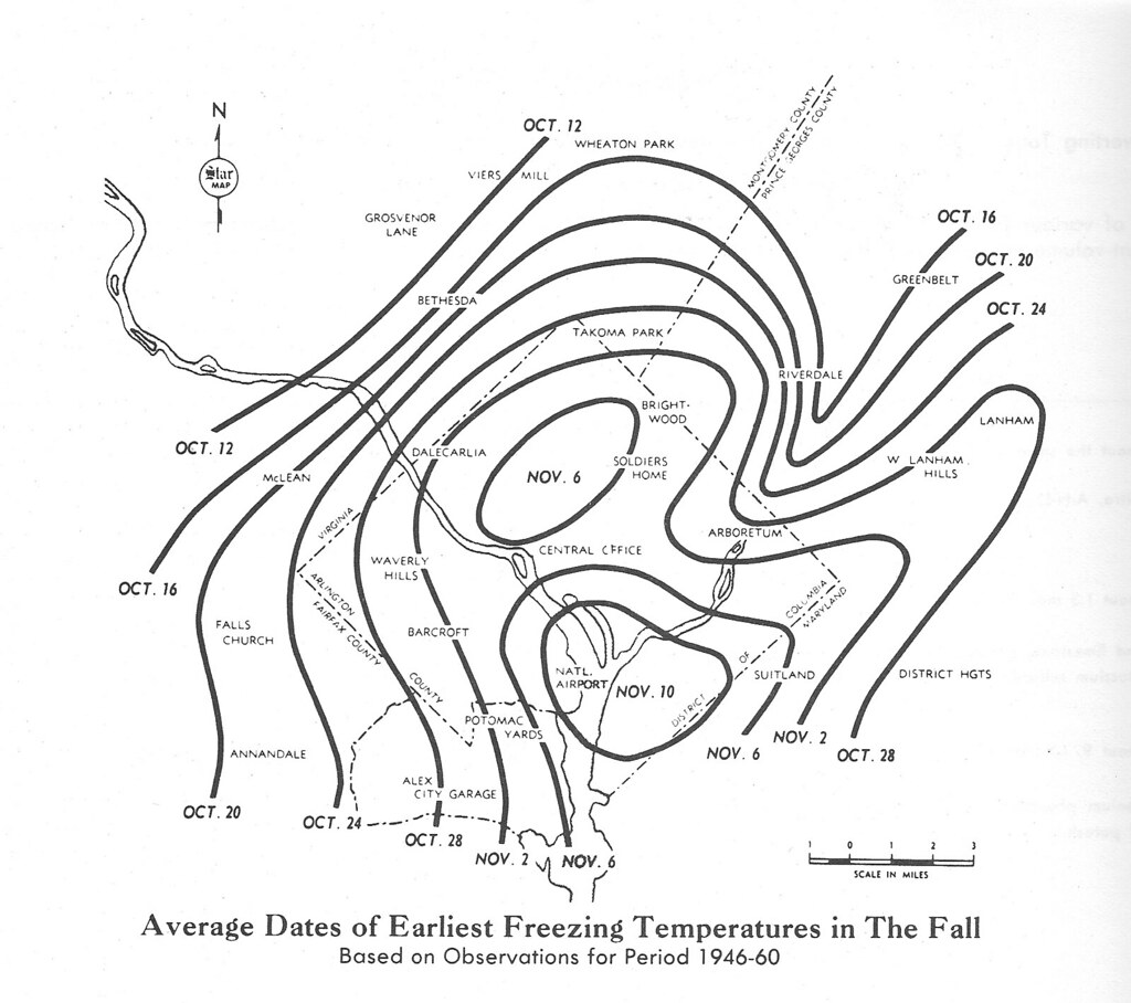
But downtown DC actually tends to freeze even later. In fact, we were sad to note that we lost almost a week off the end of our growing season just by moving from Dupont Circle to Silver Spring. This map, taken from The Washington Star Garden Book: The Encyclopedia of Gardening for the Chesapeake & Potomac Region by Deborah R. Fialka, shows a very localized picture of the average first freeze (I suspect these dates would be shifted later using more recent data):

map of first freeze dates in Washington DC metro area
What's going on in this picture? Two things: topography and urbanity. The area by National Airport, where the Potomac and the Anacostia meet, is the lowest-lying area in Washington, DC, and it freezes later than anywhere else in the metro area. The other oval on the map corresponds roughly with the Rock Creek valley.

Other than these river valleys, though, there's something else going on.  There are circles radiating out from DC not just because of altitude, but also because there is a higher density of buildings and pavement in downtown DC. And those create what's known as an "urban heat island," trapping heat. It's enough to change the weather.

Folks worried about global warming think one way to slow down climate change is to address some of the factors that create urban heat islands. For one, street trees can keep the sun off of pavement, so that it doesn't heat up as much. Likewise, green roofs and highly reflective roofs can keep buildings from absorbing so much heat.

In the meantime, you can observe the subtle differences in nature that stem from these temperature differences. Do the trees drop their leaves a little later in one place vs. another?  Do flowers last longer in the fall or come up earlier in the spring? Keep an eye out, and let us know what you see.

Thanks to Flickr user DCTropics for the map!

Friday, October 23, 2009

We Are All Smith Islanders: The Local Effects of Climate Change

In 2004 the Chesapeake Climate Action Network created the film "We Are All Smith Islanders" to put a local face on climate change. The movie shows poignant examples of how global warming is already changing the Chesapeake Bay region. Through both erosion and sea level rise, Smith Island, an inhabited island in the Bay reachable only by boat, has already lost a notable amount of land. If the sea level continues to rise as predicted, Smith Island will entirely disappear.

Tomorrow, Saturday, October 24, people all over the world will be staging events calling for action to reach 350 parts per million of carbon dioxide in the atmosphere (we're already at 390 PPM). "They’ll be school children planting 350 trees in Bangladesh," says the invite, "scientists hanging banners saying 350 on the statues on Easter Island, 350 scuba divers diving underwater at the Great Barrier Reef." The main event in DC kicks off at Malcolm X Park at noon, with a march down to the White House "mid-afternoon," wrapping up at 5:00.

Need inspiration? Watch this movie. We are all Smith Islanders.

Friday, September 4, 2009

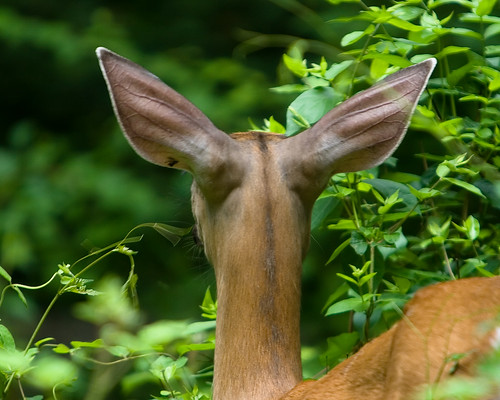
Stop Deer from Destroying Rock Creek Park

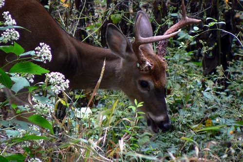
There are far too many deer in Rock Creek Park. I'm not talking about how they leave the park to eat your hostas. They're hurting the park itself. Please take a minute to read this post and do something about it.

Estimates of how many deer can live sustainably in a forest vary, but the park's science team thinks 15 to 20 deer per square mile is reasonable for Rock Creek Park. Before European settlement of this region, there were even fewer -- maybe 8 to 11 deer per square mile. The number in Rock Creek Park? As of 2007, 82 deer per square mile and growing at 20% per year. Yikes.

At this population level, deer are preventing regeneration of the forest. Tree seedlings get chomped by a passing deer before they can grow large enough to survive. The loss of vegetation can also increase erosion and stormwater runoff, and it destroys cover that protects numerous birds and other animals. Not to mention destroying the shrubs and plants themselves.
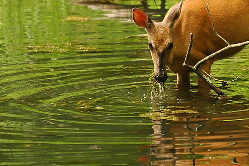
How did we get to this point? First of all, there are no deer predators left in the District, other than cars. Second, ongoing development in the suburbs creates lots of "edge" habitat where deer thrive, while simultaneously reducing hunting. And Rock Creek is part of a long green corridor that reaches into Montgomery County, meaning what is going on up there can affect conditions in the park.

In light of all this, the park has developed a new deer management plan. This 400-page report is full of interesting information (including a list of endangered and rare species in the park, bird lists, and maps of dominant vegetation types, which may inspire other posts here soon). But most importantly, it describes four alternatives for dealing with the deer:
  1. No new action - Monitoring, data management, research, and use of protective caging and repellents in landscaped areas; the deer population would likely continue to grow.
  2. Non-lethal actions - Very large fenced areas (5% of the park) would allow some forest regeneration while park staff would slowly reduce the deer population through reproductive control. There would still be a lot of damage to unfenced areas in the park while we wait for the population to decline.
  3. Lethal actions - Killing the deer through sharpshooting (and by capture and killing where sharpshooting would not be appropriate). This would rapidly reduce the deer population to a sustainable level.
  4. Both lethal and non-lethal actions (the recommended alternative) - quickly reduce the number of deer, following up with population control so they never get back to this point.
The park is asking for feedback on these options. You can weigh in by mail or online. The comment periods ends on October 2, 2009. If you love Rock Creek Park, please take a minute to submit a comment on the plan. And if you've got another minute, come back here and leave your comment as a comment on this post. We'd love to see what you said!

Like the photos in this post? Mouse over for credits; a click takes you to the photographer on Flickr.


Tuesday, September 1, 2009

Chesapeake Bay: "As Dead As the Face of the Moon"

Frontline's 2-hour special, "Poisoned Waters" is not exactly light end-of-summer fun...unless you like horror stories. But if you love the Chesapeake Bay and the Potomac, it's a highly disturbing must-watch program. As we reach the end of beach season, it seemed worth passing along.

The first hour uses our area as an example of the problems facing numerous water systems: pollution and dead zones due to sewage and runoff (sections 3&4), including a vast array of new contaminants like endocrine disruptors that are unregulated by the EPA (sections 5&6). The local examples pick back up at 1h30min, with case studies of development in "ecological disaster" Tyson's Corner and successful citizen action to slow development in Loudon County (section 12). The good news continues with "showcase for smart growth" Arlington (section 13).

One of the closing quotes:

"The estuaries and the wetlands are worth vastly more money than we have acknowledged. If we could calculate and persuade the public how valuable the wetlands are in terms of the web of life, we would be guarding them like the family jewels, instead of using them as our great sewage dump."