Showing posts with label canoe. Show all posts

Tuesday, October 6, 2009

Great Falls

For spectacular scenery within an easy drive of Washington, DC, it's hard to beat Great Falls. The wide, flat Potomac River drops 76 feet over the course of a mile, culminating in a series of rapids and 20-foot waterfalls that you can view from overlooks on either side of the river. The river then enters deep, narrow Mather Gorge, with rocky cliffs on both sides. This is about as dramatic as it gets around here.

The Maryland side, which is managed as part of the C&O Canal, is the side we usually go to -- mostly because it's easier to get there from where we live. From the C&O Canal towpath, you'll walk along a boardwalk, across a bridge that crosses some rapids that are impressive in their own right, then along a boardwalk over Olmstead Island to a view of the falls.

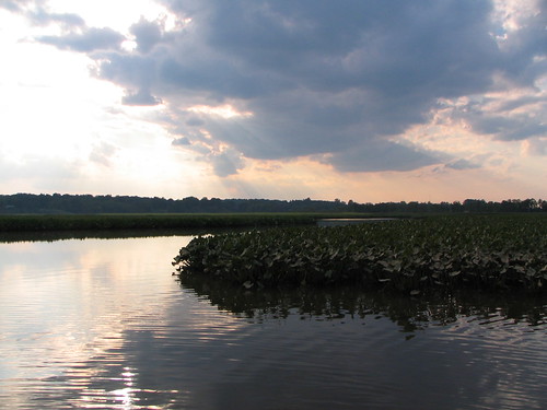
Away from the falls, you can walk for miles along the canal, as well as along several more challenging, rocky trails along the river. (See the park map and trails description.) We'll often stop by the falls, then hike the Billy Goat A trail and come back on the canal, which is a loop of about 4 miles (see this description). April through October, you can ride on a boat in the canal as it goes through the locks of the canal. Uphill from the canal, there are trails through the woods to an old gold mine -- it's not much to look at, but has an interesting history.

The Virginia side, which is managed as part of the GW Parkway, is the more heavily visited side. The park offers three overlooks of the falls here, and they involve a shorter walk than on the Maryland side -- one is just a 2 minute walk from the visitor center.

Beyond the overlooks, you'll find miles of hiking on this side of the river as well. (See the park map.) To the north, you can walk to Riverbend Park; to the south, you can catch the Difficult Run Trail, which follows that river for 15 miles through Fairfax County. See this description of a 5-mile hike that combines a stretch of Difficult Run, the path along the Potomac as it passes through Mather Gorge, the overlooks of the falls, and a return through the middle of the park on the Swamp Trail.

Entrance fee: $5/car on either side. Your receipt is good for 3 days and will get you in to both parks. Folks often park outside the parks and hike in. On the Maryland side, it's a little over 2 miles from Angler's Inn to the falls. On the Virginia side, you can park where Difficult Run crosses Georgetown Pike, also a little over 2 miles from the falls. But why not give $5 to your National Parks? They could use the cash.

Dogs: In Maryland, dogs are not allowed on the trail to the falls on the Maryland side or the Billy Goat A trail, but are allowed on the canal and other hiking trails. In Virginia, dogs are allowed throughout the parkIn both parks, dogs must be on leash. And please scoop their poop, to avoid polluting the water.

Bikes: In Maryland, bikes aren't allowed on any of the hiking paths. But you can ride to your heart's content on the C&O Canal -- you'll just need tires that can take the rough path. In Virginia, five miles of trails are open to bikes: the Old Carriage Road, Ridge, and Difficult Run trails.  Biking is not permitted on the River, Patowmack Canal, Mine Run, or Matildaville Trails.

Climbing: The cliffs along the river are a popular rock climbing destination. This site has descriptions of the routes on the Virginia side.

Kayaking: Not for the faint of heart, or inexperienced kayakers -- this is serious whitewater. These sites have descriptions of the rapids and their difficulty.

Swimming is prohibited. Several people have died swimming in this section of the Potomac.

Fishing is allowed, with the appropriate state license.

Great Falls Tavern (Maryland Side)
11710 MacArthur Blvd.
Potomac, MD 20854
301-767-3714
Great Falls Park (Virginia Side)
9200 Old Dominion Dr.
McLean, VA 22102
703-285-2965
Do you have a favorite spot or trail at Great Falls, or a story to tell? Leave us a comment!

Like the photos in this post? Mouse over for credits; a click takes you to the photographer on Flickr.

Tuesday, September 15, 2009

Patuxent River Park: Jug Bay Natural Area

The Patuxent River flows 110 miles from Parrs Ridge in Carroll County, all the way to the Chesapeake Bay. In 1968, it was designated one of Maryland's scenic rivers. And, in response to that designation, more than 6,000 acres of land are protected around the river. Jug Bay Natural Area is the headquarters of them all. In its 2,000 acres there are more than eight miles of trails, and there's more to explore on the water.

With a moderately short drive from DC (15 miles from the beltway), you'll be a world away. This part of the river is a tidal estuary. The water level rises and falls with the tide, and the flow of the river can slow or even reverse when the tide is coming in. These conditions attract a unique combination of plants and animals, and they're thriving in this protected area. More than 250 species of birds have been reported here; you're almost guaranteed to see ospreys, ducks, herons, cormorants, and red-winged blackbirds, and we often see bald eagles. The marshes have extensive swaths of wild rice, pickerel weed, and spatterdock. In the summer, joe pye weed, swamp milkweed, and ironweed attract lots of butterflies along the sides of the river. We've come across beavers and muskrats, and been delighted by many jumping fish.

Whether you get there by land or by water, we recommend a trip down to Mattaponi Creek, at the south end of the park. There, you'll find a small tower for wildlife observation, and a 1000-foot-long wooden bridge that goes through a marsh habitat. Six days a week, this area is closed to cars, but open to foot and bike traffic. On Sundays you can drive across the bridge and into Merkle Wildlife Sanctuary, on what is called the Chesapeake Bay Critical Area Tour.

(A note on names: the Jug Bay Natural Area of Patuxent River Park is on the west side of the Patuxent. There is also a fantastic park on the east side of the river called Jug Bay Wetlands Sanctuary. We'll tell you more about them in another post.)

Hiking, biking, and horses: People, mountain bikes, and horses are all allowed on the trails in this park. Stop in the park office to get a map. MAMBO has this description:  "The trails on the right (west side of the park) are mostly easy, wide lanes; the extensive system of trails to the left are more technical single-track.The trails range from wide, grassy wood lanes to twisting single-track trails littered with downed tree limbs and roots. The trails occasionally plunge into narrow creek valleys, cross wooden footbridges, and then ascend on short, steep climbs. The high clay content in the soil holds water and the paths are often wet long after it rains." 

Boating: The park has two boat ramps (Jackson Landing and Selby Landing), and offers canoe and kayak rentals for the extremely reasonable rate of $15/day ($12 for PG County residents). Reservations are required - call the park office at 301-627-6074. Be sure to look at the tide tables when you're planning your trip. It's much more fun if you're working with the tide. Boats with trailers are also allowed with a fee.

Camping:
There are two group campsites in the park, but you have to reserve them far in advance (or go mid-week). Call the park for more information.

Fishing and Hunting: Fishing is permitted with a license. Waterfowl hunting is also permitted in the park; a limited number of blind sites are leased on a seasonal basis.

Dogs: Allowed in the park, but supposed to remain on leash at all times.

Patuxent River Park
16000 Croom Airport Road
Upper Marlboro, MD 20772
301-627-6074

Tuesday, May 12, 2009

Car-free DC: Rock Creek Park

This is the second article in a series on hikes in DC that can be reached by public transportation.

Rock Creek Park is a treasure. Especially on the weekend, when Beach drive is closed, it is fairly easy to reach places in the woods where you'd have no idea you were in the city. But most DC residents have barely scratched its surface. And so, we bring you ten points of entry to this 1,754 acre park in the heart of the city. We suggest a couple of our favorite circuit hikes below; you can follow along -- or come up with your own routes -- using this park map.

North to south (downstream):

  1. Boundary Bridge – Riley Spring Bridge loop: The hike that includes these two bridges, using the Valley Trail in one direction and the Western Ridge Trail in the other direction, is one of our favorites. You have two options for accessing this loop by public transit. To come in from the Valley Trail side, take one of the S buses that runs along 16th St. and get off at Juniper St. or Holly St. Alternatively, you can enter from the north: it's about three quarters of a mile from a bus stop on East-West Highway to Boundary Bridge. Take the J2 or J3 buses, which run from Silver Spring Metro to Bethesda Metro and stop at Jones Mill Road/Beach Drive, or Ride On Bus # 1, which runs between Silver Spring and Friendship Heights.
  2. Pinehurst Branch: The Pinehurst Branch is another favorite trail of ours; it follows a tributary of Rock Creek. The S bus Whittier St. stop on 16th St. is the closest we know of. There are several good trails going both south and north from here, leading to possibilities for one-way hikes between Whittier St. and points further north on 16th St., or the Nature Center.
  3. Nature Center: it's not huge, but they've got maps and other info and displays to help orient you to the park. Rangers also lead activities from here, and you can access several trails. The E2/3/4 buses stop at the intersection of Military Rd. and 27th St., on their run between Friendship Heights and Fort Totten.
  4. Soapstone Valley: This area was named "Best Place in Rock Creek Park You’ve Never Been To" in the City Paper's Best of DC 2008. Native Americans quarried several rock deposits in the area for tool supplies. You'll follow a small stream down to where it meets Rock Creek. From Van Ness Metro, you can find trailheads on either Yuma or Albemarle St.
  5. Carter Barron: another stop on the 16th St. S bus. We usually walk down Morrow Dr. to the park police station, where you can pick up the Valley Trail. Be forwarned, though, that there's no walking path on Morrow Dr. – you'll be on the shoulder.
  6. Peirce Mill: This was an 1820s gristmill whose waterwheel ran off Rock Creek. Nearby, the Art Barn is a carriage house that now serves as an art gallery. You can get there via Soapstone Valley, or come in through the Melvin C. Hazen Park, which is between the Van Ness and Cleveland Park Metro stops (enter between Rodman and Sedgwick on the east side of Connecticut Ave.)
  7. Piney Branch Parkway: Matt always wows groups with this route into the park. People can't believe how quickly you can reach tranquility from the bustle of the city. From Columbia Heights Metro, take Irving St. west, then take Mt. Pleasant St. north, jog left on Park Dr., then right again to continue north on Mt. Pleasant. The road dead-ends at a trailhead that will put you onto the trail that follows the Piney Branch Parkway.
  8. The Zoo: As you can see on the map, the National Zoo is not part of Rock Creek Park, but it's nestled right in there. From Woodley Park metro, one option is to go through the zoo and pick up the trail that follows the creek on the backside, near the kids' farm area. Alternatively you can go down the big hill along 24th St. as it heads down into the park. The stretch of park south of here has an exercise circuit with various stations. Note how narrow the park is getting down here – the trails continue along the creek, but you're right next to the Parkway – and unlike Beach Drive, it doesn't close down on weekends.
  9. P Street: Another access point to the stretch of the park south of Woodley Park, an easy walk from the Dupont Circle metro. Make sure you go down on the side of the Parkway that you want to be on, because there's too much traffic to cross easily (or safely). It's still pretty despite the cars, though.
  10. Thompson Boat Center: perched at the confluence of Rock Creek and the Potomac, the last stop in Rock Creek Park gives you a chance to explore in another way. The boat center offers boat rentals and lessons. It's about a half mile from Foggy Bottom Metro: go west on I St., left on New Hampshire, then right on Virginia, where you'll walk past the Watergate and then across the Parkway into the boat center. If the Red Line is more convenient, you can also get off at Farragut North and catch the 80 bus toward the Kennedy Center, getting off at New Hampshire and Virginia.


Other info:

Dogs: Dogs are welcome, but are supposed to be on-leash. And, of course, scoop your poop!

Bikes: Allowed on the trails marked as solid grey lines on the park map. In addition, large sections of Beach Drive are closed to cars on weekends (marked in yellow on the park map). Bikes can be stashed on the front of any Metrobus; you can take your bike on Metro anytime on the weekend, and anytime except 7-10am and 4-7pm during the week.

Do you have other tips on accessing Rock Creek? Have you visited recently? Leave a comment and let us know.