
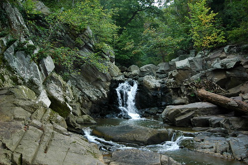
 Scott's Run is one of the rare parks in the area that compels us to get into our car and drive on the Beltway just to go hiking there. It's got a small river with multiple small falls that culminate in a 15-foot waterfall as it joins the Potomac. You'll also see birds, wildflowers, and the most extensive population of hemlocks that we know of in the area.
 This park is perhaps all the more valuable because Scott's Run has a much less lovely beginning: it starts directly below a parking lot at Tyson’s Corner Mall. As it flows to the Potomac, Scott's Run passes through highly-developed Fairfax County. But, in 1970, when this 336 acre tract of land along Scott's Run was slated to be turned into a housing development, citizens banded together and voted in a referendum to tax themselves in order to buy the land for $3.6 million and make it into a park instead. It was a hard-won fight, and we should give thanks every time we visit that things ended the way they did.
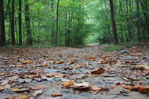 For any hike in this park, be prepared for steep hills as you enter the Potomac river valley. But trails are well maintained, with a range between wide, smooth trails and rock scrambling. There is a map of the park at each trailhead.
As you'll see on the map, the Potomac Heritage Trail passes through the park. From here, you can follow the PHT from here 10.8 miles south to Roosevelt Island. Trail proponents hope to someday link Scott's Run to Great Falls, which is a little less than 5 miles upstream from Scott's Run. Eventually, they hope to link some 830 miles of trails along the Potomac River.
For something a little shorter, Hiking Upward describes a 2.2 mile loop that takes you through much of the park, similar to the route we often take. We also like the River Trail, on the western side of the waterfall, because it ends up at a nice, secluded spot on the Potomac with views of big rock outcrops across the river.
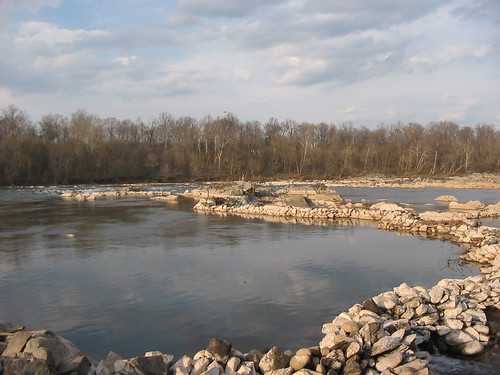 As you walk along the Potomac to the east of the Scott's Run waterfall, keep an eye out for long, curved rows of stacked rocks in the river. This is an old fishing weir. The rows of stones channel fish to a single break in the rock wall, where typically a net or a basket would be waiting to catch them. I haven't been able to find any information on how old this structure is -- Native Americans definitely used this technique, but so did colonial settlers. More recently, weirs have been used as a way to protect fish as they're being introduced into a river.
Fishing is allowed, with the appropriate license.
Swimming is not allowed in the park, largely because of health reasons. Do you really want to swim in the storm runoff from Tyson’s Corner? (Which raises a question about fishing, as well, but apparently that's up to you.)
Dogs are allowed in the park, but must remain on leash. And please scoop their poop, or it will just pollute the river that much more.
Bikes are not allowed.
There are no bathrooms or any other facilities at the preserve.
Directions: From the Beltway in McLean, take exit 13. Go left on Georgetown Pike and in less than a mile, turn right into the parking lot. Or, keep going and there's another parking lot, also on the right.
Scott's Run Nature Preserve
7400 Georgetown Pike, McLean, VA 22102
Like the photos in this post? Mouse over for credits; a click takes you to the photographer on Flickr.

