

Showing posts with label Fairfax County. Show all posts

Tuesday, January 26, 2010

Rainy Day Nature: Planetariums in the DC Area

Some friends of ours are making an effort to learn a little astronomy, since their four year old seems to be taking a natural interest in the stars and planets (hi Solomon!). But it's awfully chilly to be outside at night right now, even if the darkness does start nice and early. Which led us to say, hey, aren't there a couple of planetariums around DC? Turns out, there's more than a couple.

illustration outside the Rock Creek Park planetariumWe've been to the one in the Rock Creek Nature Center (5200 Glover Road, NW; 202-895-6070). It's a small 75-seat space but the rangers do a nice job of putting together a variety of programs. In general, they have the following schedule of 45-60 minute, age-rated shows (check this week's exact topics here):
  • Saturdays and Sundays at 1:00: ages 5+
  • Saturdays and Sundays at 4:00: ages 7+
  • Wednesday afternoons at 4:00: ages 4+
Tickets to Rock Creek Planetarium shows are free and can be picked up at the information desk in the Nature Center a half hour before the show.

einstein planetarium ticketsThere's also the Einstein Planetarium at the Air and Space Museum (1-877-932-4629). With a 70-foot dome and 233 seats, it's a totally different experience from the planetarium at Rock Creek Park. Their website touts that "you'll feel the sensation of zooming through the cosmos, enveloped in color saturated moving images and spine-tingling sound." They offer 25 minute shows every half hour, from 11:00 to 5:00.  Tickets for these shows are $8.75 for adults, $7.25 for youth. But there are also FREE shows at 10:30 AM on selected days, including Saturdays (see schedule).

In addition to the two planetariums we knew about, we were surprised to discover that several local school systems have planetariums. These are used primarily for school groups, but also offer programs for the public. 

Prince George's Howard B. Owens Science Center in Lanham (9601 Greenbelt Road; 301-918-8750) has a 55-foot dome with 174 seats -- the largest planetarium in Maryland. Public programs are on the first Friday of every month during the school year. Tickets are $4 for adults and $2 for students and seniors. (Power Point slide of this spring's programs here.)

Arlington's 70-seat David M. Brown Planetarium (1426 N. Quincy St.) offers a kid-oriented public program on Friday and Saturday evenings and Sunday afternoons during the school year (it appears to be the same show every time; see schedule).  They also hold a program on the first Monday of the month that focuses on the current night sky and includes an interactive talk with the planetarium director, followed by the opportunity to use outdoor telescopes if weather permits. Tickets for all events are $3 for adults, $2 for children and seniors.

At 24 feet wide and just 42 seats, the Montgomery College planetarium (about 7651 Fenton Street; see directions) is pretty tiny. But it was an exciting find, since it's right down the street from us! It's open to the public for free shows once a month or so during the academic year, on Saturday nights at 7:00 (see schedule). Compared to several other planetariums, the show topics appear to be more adult-oriented (Space-Time Invariance and Quantum Gravity, anyone?). Shows are followed by the opportunity to use telescopes outdoors, weather permitting.

Even smaller, the Alexandria planetarium at TC Williams High School (3330 King St., 703-824-6805) has just 35 seats available, so they require advance registration for their monthly hour-long shows (see schedule).

Have you been to any of the shows at these planetariums? Leave a review in the comments section -- it'll take us a while before we make it to all of them!

Like the photos in this post? Mouse over for credits; a click takes you to the photographer on Flickr.

Tuesday, November 24, 2009

Natural Places in the DC Area To Take Your Out-of-Town Visitors

If you're like us, you've got company coming for Thanksgiving. Some ideas on where to take your guests, for Thanksgiving or at any other time of the year:

Great Falls has always been our default guest-taking spot. There's really nothing like it in the DC area. The views of the falls are great from either side, though the Washington City Paper dubbed Cow Hoof Rock, on the Virginia side, as the best view of the Potomac last year. You have a choice of gentle trails (like the C&O Canal towpath in MD or the Swamp Trail in VA), or rugged trails (like the Billy Goat Trail in MD), for your guests to choose from. $5 admission.

Several Natural Capital readers said they take their guests to the National Arboretum. There's so much to choose from -- everything from very natural-looking and un-manicured Fern Valley, to an indoor bonsai exhibit with trees that have been maintained for hundreds of years. Plus the old Capital columns arranged to look like a Greek temple are a treat for architecture and history buffs.  The grounds are open every day from 8 to 5, but the bonsai exhibit is closed on Thanksgiving Day and open on other days only from 10 to 4, so plan accordingly. Free.

If you're going to be down on the Mall, make a detour from all the museums to the US Botanic Garden. Even if you just pop in for a few minutes to see the orchid exhibit, your guests will be impressed. Plus, starting on Thanksgiving, they have a toy train that goes through landscapes and buildings made of sticks, seeds, and other plant-based materials, along with a giant Christmas tree and lots of poinsettias. Free.

Thanksgiving bonus: Take 'em to Turkey Run. Not just for the name -- though that's while we suggest it -- but because it's a pretty spot on the Potomac, where you'll have to climb hills. And we suspect you'll have a few extra calories you'll be wanting to work off this weekend. Free.

Tuesday, November 17, 2009

Turkey Run Park

Dead Run, Turkey Run ParkI hate to admit it, but for several years, my main familiarity with Turkey Run was as a spot to turn around when I missed a turn-off on the GW Parkway. It's a shame, because it's a great park, with 700 acres and almost 3 miles of shoreline along the Potomac. We feature it this week in honor of the upcoming Thanksgiving holiday.

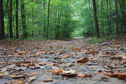
Not surprisingly, since it's just down the river, the topography of Turkey Run is very similar to that of Scott's Run. You'll drop down from upland woods into the rich bottomland flood plain of the Potomac River. And when I say "drop," I mean drop...nearly 200 feet over about a quarter mile of trail. It makes for lovely streams tumbling down to the Potomac...and a tough climb back up.

In the spring, Turkey Run Park is full of wildflowers, especially bluebells along the Potomac. In the fall, it's time to catch the turning leaves. And, once leaves are down, to catch better views of the river.

Top of the switchbacks, Turkey Run ParkYou have three good options for loop hikes at Turkey Run. All start by heading down the steep switchback trail that leaves from Parking Lot C:
  1. The shortest option is to go left along the Potomac, then follow Turkey Run back uphill and cross over to the parking lot (see the yellow trail on this map). This can be extended by walking along the Potomac and then doubling back. Total hike is only about a mile, but it will feel like more since it's all up and down.
  2. At the bottom of the switchbacks, if you go to the left, it's about a mile to the next stream, which is called Dead Run. Follow Dead Run uphill and follow these directions to get back to the parking lot. Total hike is 3.9 miles.
  3. At the bottom of the switchbacks, go right, and hike along the Potomac until you reach the Woods Trail (see the green and pink trails on this map). This will take you up the hill, past Parking Lots A and B, and back to Parking Lot C. Total hike is about 3 miles.
Of course, parts of these options can be mixed and matched, as you'll see when you look at the maps. If you want to go even farther, you can follow the Potomac River all the way to Roosevelt Island on the Potomac Heritage Trail -- it's just over 8 miles.

Other info:

The entrance to Turkey Run is about 2 miles inside the Beltway (exit 43) on  the GW Parkway. It's not accessible by public transportation as far as we can tell.

The park is free and open sunrise to sunset, every day. There are picnic tables, restrooms, and water fountains near the parking lots.

Bikes are not allowed.
Dogs are allowed, but must remain on leash.


Turkey Run Park
McLean, VA, 22101
(703)289-2500

Like the photos in this post? Mouse over for credits; a click takes you to the photographer on Flickr.

Tuesday, November 3, 2009

Scott's Run Nature Preserve

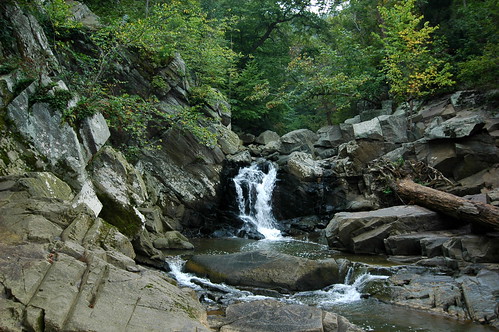
Scott's Run is one of the rare parks in the area that compels us to get into our car and drive on the Beltway just to go hiking there. It's got a small river with multiple small falls that culminate in a 15-foot waterfall as it joins the Potomac. You'll also see birds, wildflowers, and the most extensive population of hemlocks that we know of in the area.

This park is perhaps all the more valuable because Scott's Run has a much less lovely beginning: it starts directly below a parking lot at Tyson’s Corner Mall. As it flows to the Potomac, Scott's Run passes through highly-developed Fairfax County. But, in 1970, when this 336 acre tract of land along Scott's Run was slated to be turned into a housing development, citizens banded together and voted in a referendum to tax themselves in order to buy the land for $3.6 million and make it into a park instead. It was a hard-won fight, and we should give thanks every time we visit that things ended the way they did.

For any hike in this park, be prepared for steep hills as you enter the Potomac river valley. But trails are well maintained, with a range between wide, smooth trails and rock scrambling. There is a map of the park at each trailhead.

As you'll see on the map, the Potomac Heritage Trail passes through the park. From here, you can follow the PHT from here 10.8 miles south to Roosevelt Island. Trail proponents hope to someday link Scott's Run to Great Falls, which is a little less than 5 miles upstream from Scott's Run. Eventually, they hope to link some 830 miles of trails along the Potomac River.

For something a little shorter, Hiking Upward describes a 2.2 mile loop that takes you through much of the park, similar to the route we often take. We also like the River Trail, on the western side of the waterfall, because it ends up at a nice, secluded spot on the Potomac with views of big rock outcrops across the river.

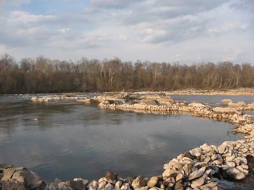
As you walk along the Potomac to the east of the Scott's Run waterfall, keep an eye out for long, curved rows of stacked rocks in the river. This is an old fishing weir. The rows of stones channel fish to a single break in the rock wall, where typically a net or a basket would be waiting to catch them. I haven't been able to find any information on how old this structure is -- Native Americans definitely used this technique, but so did colonial settlers. More recently, weirs have been used as a way to protect fish as they're being introduced into a river.


Fishing is allowed, with the appropriate license.

Swimming is not allowed in the park, largely because of health reasons. Do you really want to swim in the storm runoff from Tyson’s Corner? (Which raises a question about fishing, as well, but apparently that's up to you.)

Dogs are allowed in the park, but must remain on leash. And please scoop their poop, or it will just pollute the river that much more.

Bikes are not allowed.

There are no bathrooms or any other facilities at the preserve.

Directions: From the Beltway in McLean, take exit 13. Go left on Georgetown Pike and in less than a mile, turn right into the parking lot. Or, keep going and there's another parking lot, also on the right.

Scott's Run Nature Preserve
7400 Georgetown Pike, McLean, VA 22102

Like the photos in this post? Mouse over for credits; a click takes you to the photographer on Flickr.
Tuesday, October 6, 2009

Great Falls

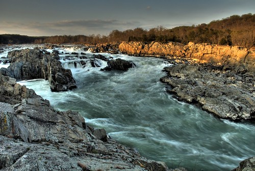
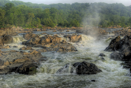
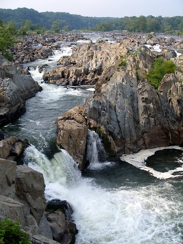
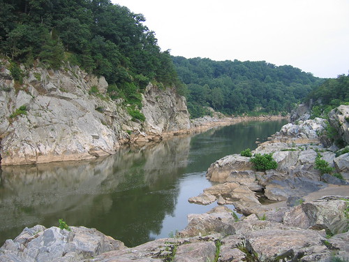
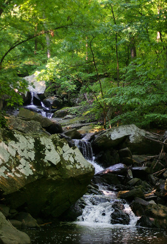
For spectacular scenery within an easy drive of Washington, DC, it's hard to beat Great Falls. The wide, flat Potomac River drops 76 feet over the course of a mile, culminating in a series of rapids and 20-foot waterfalls that you can view from overlooks on either side of the river. The river then enters deep, narrow Mather Gorge, with rocky cliffs on both sides. This is about as dramatic as it gets around here.

The Maryland side, which is managed as part of the C&O Canal, is the side we usually go to -- mostly because it's easier to get there from where we live. From the C&O Canal towpath, you'll walk along a boardwalk, across a bridge that crosses some rapids that are impressive in their own right, then along a boardwalk over Olmstead Island to a view of the falls.

Away from the falls, you can walk for miles along the canal, as well as along several more challenging, rocky trails along the river. (See the park map and trails description.) We'll often stop by the falls, then hike the Billy Goat A trail and come back on the canal, which is a loop of about 4 miles (see this description). April through October, you can ride on a boat in the canal as it goes through the locks of the canal. Uphill from the canal, there are trails through the woods to an old gold mine -- it's not much to look at, but has an interesting history.

The Virginia side, which is managed as part of the GW Parkway, is the more heavily visited side. The park offers three overlooks of the falls here, and they involve a shorter walk than on the Maryland side -- one is just a 2 minute walk from the visitor center.

Beyond the overlooks, you'll find miles of hiking on this side of the river as well. (See the park map.) To the north, you can walk to Riverbend Park; to the south, you can catch the Difficult Run Trail, which follows that river for 15 miles through Fairfax County. See this description of a 5-mile hike that combines a stretch of Difficult Run, the path along the Potomac as it passes through Mather Gorge, the overlooks of the falls, and a return through the middle of the park on the Swamp Trail.

Entrance fee: $5/car on either side. Your receipt is good for 3 days and will get you in to both parks. Folks often park outside the parks and hike in. On the Maryland side, it's a little over 2 miles from Angler's Inn to the falls. On the Virginia side, you can park where Difficult Run crosses Georgetown Pike, also a little over 2 miles from the falls. But why not give $5 to your National Parks? They could use the cash.

Dogs: In Maryland, dogs are not allowed on the trail to the falls on the Maryland side or the Billy Goat A trail, but are allowed on the canal and other hiking trails. In Virginia, dogs are allowed throughout the park.  In both parks, dogs must be on leash. And please scoop their poop, to avoid polluting the water.

Bikes: In Maryland, bikes aren't allowed on any of the hiking paths. But you can ride to your heart's content on the C&O Canal -- you'll just need tires that can take the rough path. In Virginia, five miles of trails are open to bikes: the Old Carriage Road, Ridge, and Difficult Run trails.  Biking is not permitted on the River, Patowmack Canal, Mine Run, or Matildaville Trails.

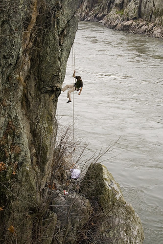
Climbing: The cliffs along the river are a popular rock climbing destination. This site has descriptions of the routes on the Virginia side.

Kayaking: Not for the faint of heart, or inexperienced kayakers -- this is serious whitewater. These sites have descriptions of the rapids and their difficulty.

Swimming is prohibited. Several people have died swimming in this section of the Potomac.

Fishing is allowed, with the appropriate state license.

Great Falls Tavern (Maryland Side)
11710 MacArthur Blvd.
Potomac, MD 20854
301-767-3714
Great Falls Park (Virginia Side)
9200 Old Dominion Dr.
McLean, VA 22102
703-285-2965
Do you have a favorite spot or trail at Great Falls, or a story to tell? Leave us a comment!

Like the photos in this post? Mouse over for credits; a click takes you to the photographer on Flickr.
Tuesday, August 25, 2009

Car Free DC: Huntley Meadows

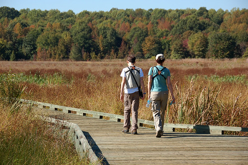
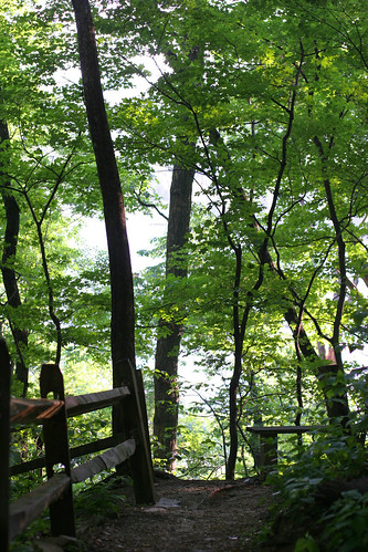
Huntley Meadows Park is 1,425 acre park of wetlands, meadows, and forest just south of the Beltway in Fairfax County. The varied environments create wonderful habitat for wildlife, including over 200 species of birds, as well as beavers, otters, frogs, dragonflies, and other wetland-loving animals.

The core attraction of the park is a .7-mile boardwalk trail from the visitor's center, through the wetland area, to an observation tower.There is also a network of official and unofficial trails through the park that will take you through woodland and wildflower meadows. This map is the most thorough I've been able to find; the official map centers on the boardwalk and the Cedar Trail, which creates a loop.

The fate of Huntley Meadows has been under debate. The wetlands are in decline, but there is controversy over whether humans or nature can better restore them. The current plan is to build an artificial dam that will do the work of beavers who have moved further downstream.

Getting there: From Huntington Avenue Metro station, you can take Fairfax Connector Bus 161 or 162 to the main entrance of the park; it's another .3 mile to the visitor center.

Huntley Meadows is a little over 3.5 miles from the beltway -- take exit 177A (Richmond Highway /Route 1) and go south to a right on Lockheed Boulevard. The park entrance is approximately a half mile down at Harrison Lane.

Admission & Hours: Free. Open dawn to dark every day. See website for visitor center hours.

Bikes: Bicycling is not permitted on the boardwalk trail from the visitor center. However, there is a hiker-biker trail which has a separate entrance to the park at South Kings Highway near Telegraph Road. This 1.2 mile trail ends at another observation tower.

Dogs:
Aren't allowed on the boardwalk, but are allowed on other trails.

Huntley Meadows Park
3701 Lockheed Blvd., Alexandria, VA 22306
703-768-2525

Like the photos in this post? Mouse over for credits; a click takes you to the photographer on Flickr.