Showing posts with label Bike. Show all posts

Tuesday, March 23, 2010

C&O: the McKee-Beshers Wildlife Management Area

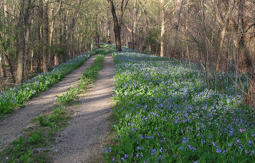
Bluebells along the C&O Canal towpath
Photo credit: LostBob Photos(Flickr Creative Commons)
This week we're venturing outside the beltway to tell you about one of our favorite places to see spring wildflowers: McKee-Beshers Wildlife Management Area. It's a sweet little stretch along the C&O Canal that will be bursting with color in April.

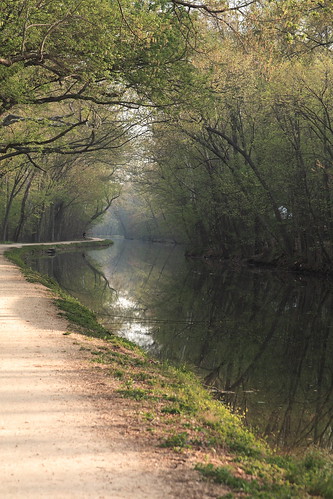
This is not the canal of Great Falls and Georgetown. The sides have caved in, the plants have taken over -- it's basically a series of ponds rather than a recognizable canal. But the towpath remains, and the Potomac on the other side of it. On the other side of the canal are fields and woods that are managed mainly for attracting wildlife for hunters. And all around, the flowers.


Photo credit: The Natural Capital
In fact, I suspect there may be more flowers along the canal here because it's bordered by this Wildlife Management Area (and Seneca Creek State Park, which also allows hunting). Allowing people to shoot the deer may be keeping the browsing down a little more here compared to other parks in our area, where the deer population is out of control and eating anything they can get their hooves on. Just a theory.

In addition to the spring, McKee-Beshers is also fun to visit in summer: some of the wildlife-attracting fields are planted with sunflowers, which should be blooming around mid-July.

Hiking and biking: Your main option is to go out and back on the canal, in either direction. Hunting Quarter Road is also lightly used outside hunting season and offers some different scenery (see park map). It's good to be aware of hunting seasons -- wild turkey season starts on April 17.

Golden ragwort along the C&O Canal
Photo credit: The Natural Capital
Directions: From the Beltway, take exit 39 for River Road (Rte 190) west, in the direction of Potomac. Go for 11 miles. Where River Road intersects Seneca Road, go left to stay on River Road. Keep going for 4.8 miles, then turn left on Sycamore Landing Road. There's a dirt parking lot near the end. This is the parking area closest to the towpath. (Google Map)

Tuesday, February 16, 2010

Car Free DC: Wheaton Regional Park

trees and water, Brookside GardensAt 536 acres, Wheaton Regional Park is one of the largest parks in Montgomery County, and probably the most diverse in recreational opportunities. On the western edge of the park is a humongous playground area, a 1915 carousel, and a kids' train. On the south side of the park, there is an athletic complex, an ice skating rink, and a half-acre dog park. To the north are stables and the beautiful Brookside Gardens (which deserves its own post).

And surrounded by all this recreational development? The woods. Wheaton Regional Park boasts 11 miles of trails, with about half being paved and half unpaved (see the park map). Those trails also link up to the Northwest Branch trail and the paved Sligo Creek trail, expanding your options far beyond the park.

Stop by Brookside Nature Center for some guaranteed critter sightings -- they usually have some box turtles and other reptiles and amphibians inside. They've also got interactive stations along the boardwalk that leads up to the nature center, including bird songs and smells for you to identify.

Brookside Maple Sugar Festival 2009The Nature Center also leads lots of activities. Coming up this weekend (Feb. 20-21): their Maple Sugar Festival (11:00-3:00 Saturday and Sunday, rain or shine). Start out with a movie and a short talk on the process of sap and making syrup at the nature center. Then head down the trail to a historic log cabin, where you can see trees that have been tapped, then watch the sap boiling over an open fire. Perhaps most importantly, you can compare the taste of homemade maple syrup against commercial brands on (silver-dollar-sized) pancakes. It's all free, and it's a great excuse to come check out some of the other things this great park has to offer.

people on trailHiking: Our favorite trails are the unpaved network of trails (purple on the park map) that link into the Brookside Nature Center. Pine Lake is also nice, and contrary to what the map shows, it is possible to walk all the way around it if you're willing to brave a little mud.

Bikes: Are allowed on the paved trails and some of the unpaved trails, but not the ones immediately around the Nature Center (this is noted on trail markers). There are sometimes large trees down in some of the trails; be prepared for the possibility that you may have to get your bike over a tree, or turn back around.

Dogs: Are allowed in most of the park, on leash, but are not allowed in Brookside Gardens.

Fishing: Is allowed in Pine Lake, with a Maryland fishing license.

Glenmont MetroGetting there by public transportation: Glenmont Metro is about a mile away from the entrance to Brookside Gardens and the playground entrance. There are bus routes that can get you even closer.

To the Brookside entrance (#2 on the park map): Catch Ride On bus 10 or Metrobus C8 -- they will take you to the intersection of Randolph Road and Heurich Road, about .2 miles from the Brookside entrance.

To the playground entrance (#1 on the park map): Glenmont Metro station is about a mile away. You can catch Metrobus Y8/9 to the intersection of Georgia and Shorefield, about .3 miles from the park entrance.

If you're going on a weekday, you can also catch a bus that will leave you on the eastern edge of the park. You want Ride On bus 31, which runs between Glenmont and Wheaton. It has stops along Kemp Mill Road at Randolph Road (near the horse stables, #5 on the park map) and also at Kemp Mill Forest Road (not shown on the map).

Brookside Nature Center     Wheaton Regional Park
1400 Glenallan Ave.      2000 Shorefield Road
Wheaton, MD 20902      Wheaton, MD 20902
301-962-1480     301-680-3803

Like the photos in this post? Mouse over for credits; a click takes you to the photographer's website.

Tuesday, October 6, 2009

Great Falls

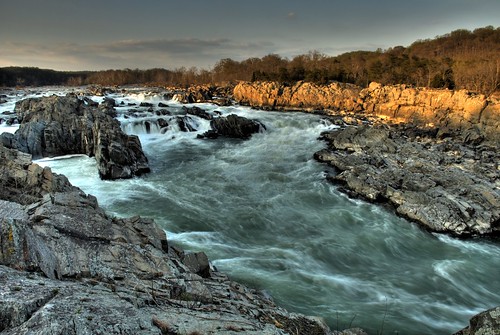
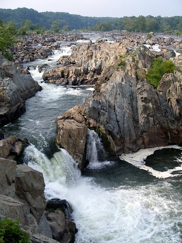
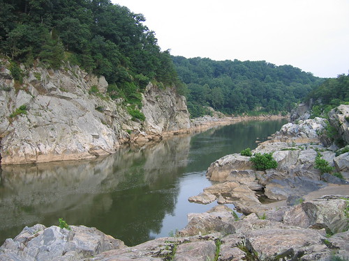
For spectacular scenery within an easy drive of Washington, DC, it's hard to beat Great Falls. The wide, flat Potomac River drops 76 feet over the course of a mile, culminating in a series of rapids and 20-foot waterfalls that you can view from overlooks on either side of the river. The river then enters deep, narrow Mather Gorge, with rocky cliffs on both sides. This is about as dramatic as it gets around here.
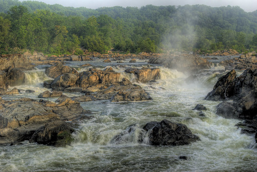
The Maryland side, which is managed as part of the C&O Canal, is the side we usually go to -- mostly because it's easier to get there from where we live. From the C&O Canal towpath, you'll walk along a boardwalk, across a bridge that crosses some rapids that are impressive in their own right, then along a boardwalk over Olmstead Island to a view of the falls.

Away from the falls, you can walk for miles along the canal, as well as along several more challenging, rocky trails along the river. (See the park map and trails description.) We'll often stop by the falls, then hike the Billy Goat A trail and come back on the canal, which is a loop of about 4 miles (see this description). April through October, you can ride on a boat in the canal as it goes through the locks of the canal. Uphill from the canal, there are trails through the woods to an old gold mine -- it's not much to look at, but has an interesting history.
The Virginia side, which is managed as part of the GW Parkway, is the more heavily visited side. The park offers three overlooks of the falls here, and they involve a shorter walk than on the Maryland side -- one is just a 2 minute walk from the visitor center.

Beyond the overlooks, you'll find miles of hiking on this side of the river as well. (See the park map.) To the north, you can walk to Riverbend Park; to the south, you can catch the Difficult Run Trail, which follows that river for 15 miles through Fairfax County. See this description of a 5-mile hike that combines a stretch of Difficult Run, the path along the Potomac as it passes through Mather Gorge, the overlooks of the falls, and a return through the middle of the park on the Swamp Trail.
Entrance fee: $5/car on either side. Your receipt is good for 3 days and will get you in to both parks. Folks often park outside the parks and hike in. On the Maryland side, it's a little over 2 miles from Angler's Inn to the falls. On the Virginia side, you can park where Difficult Run crosses Georgetown Pike, also a little over 2 miles from the falls. But why not give $5 to your National Parks? They could use the cash.
Dogs: In Maryland, dogs are not allowed on the trail to the falls on the Maryland side or the Billy Goat A trail, but are allowed on the canal and other hiking trails. In Virginia, dogs are allowed throughout the park.  In both parks, dogs must be on leash. And please scoop their poop, to avoid polluting the water.

Bikes: In Maryland, bikes aren't allowed on any of the hiking paths. But you can ride to your heart's content on the C&O Canal -- you'll just need tires that can take the rough path. In Virginia, five miles of trails are open to bikes: the Old Carriage Road, Ridge, and Difficult Run trails.  Biking is not permitted on the River, Patowmack Canal, Mine Run, or Matildaville Trails.

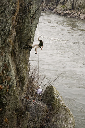
Climbing: The cliffs along the river are a popular rock climbing destination. This site has descriptions of the routes on the Virginia side.

Kayaking: Not for the faint of heart, or inexperienced kayakers -- this is serious whitewater. These sites have descriptions of the rapids and their difficulty.

Swimming is prohibited. Several people have died swimming in this section of the Potomac.

Fishing is allowed, with the appropriate state license.

Great Falls Tavern (Maryland Side)
11710 MacArthur Blvd.
Potomac, MD 20854
301-767-3714
Great Falls Park (Virginia Side)
9200 Old Dominion Dr.
McLean, VA 22102
703-285-2965
Do you have a favorite spot or trail at Great Falls, or a story to tell? Leave us a comment!

Like the photos in this post? Mouse over for credits; a click takes you to the photographer on Flickr.


Tuesday, August 25, 2009

Car Free DC: Huntley Meadows

Huntley Meadows Park is 1,425 acre park of wetlands, meadows, and forest just south of the Beltway in Fairfax County. The varied environments create wonderful habitat for wildlife, including over 200 species of birds, as well as beavers, otters, frogs, dragonflies, and other wetland-loving animals.

The core attraction of the park is a .7-mile boardwalk trail from the visitor's center, through the wetland area, to an observation tower.There is also a network of official and unofficial trails through the park that will take you through woodland and wildflower meadows. This map is the most thorough I've been able to find; the official map centers on the boardwalk and the Cedar Trail, which creates a loop.

The fate of Huntley Meadows has been under debate. The wetlands are in decline, but there is controversy over whether humans or nature can better restore them. The current plan is to build an artificial dam that will do the work of beavers who have moved further downstream.

Getting there: From Huntington Avenue Metro station, you can take Fairfax Connector Bus 161 or 162 to the main entrance of the park; it's another .3 mile to the visitor center.

Huntley Meadows is a little over 3.5 miles from the beltway -- take exit 177A (Richmond Highway /Route 1) and go south to a right on Lockheed Boulevard. The park entrance is approximately a half mile down at Harrison Lane.

Admission & Hours: Free. Open dawn to dark every day. See website for visitor center hours.

Bikes: Bicycling is not permitted on the boardwalk trail from the visitor center. However, there is a hiker-biker trail which has a separate entrance to the park at South Kings Highway near Telegraph Road. This 1.2 mile trail ends at another observation tower.

Dogs:
Aren't allowed on the boardwalk, but are allowed on other trails.

Huntley Meadows Park
3701 Lockheed Blvd., Alexandria, VA 22306
703-768-2525

Like the photos in this post? Mouse over for credits; a click takes you to the photographer on Flickr.

Tuesday, August 4, 2009

More Resources for Planning Your Hike or Bike on Trails in the DC Area

We've been enjoying compiling our own descriptions of some of our favorite parks, and hope to continue. But we also thought we'd pass along some other excellent resources for finding trails in the DC area.

Running Around Town (RunDC.com) has an extensive collection of trail descriptions, complete with mileage counts, directions, and even suggestions for nearby restaurants. Although they were compiled for runners, most are also relevant for hikers.

The Washington Area Bicyclists Association has a good set of links to maps of local trails.

Trail Voice is a new website that posts once a week about local trails, and the organizations and individuals that preserve and protect those places. Each post has a brief trail description and links to a relevant map.

Local Hikes has a big mix of hikes that may or may not seem "local" to you, but there are certainly several inside and near the beltway. Most trail descriptions are short, but they give a sense of what you're in for; additional comments (with star ratings) are posted by other hikers.

Hiking Upward has hike descriptions for several parks in Virginia and West Virginia. As suggested by the name, most are well outside the beltway, in the mountains. But a few closer-in hikes along the Potomac are included. There is a helpful summary page that allows you to pick hikes by location, or by any of the other factors they're rated by: difficulty, streams, views, solitude, and camping. On each trail's page, there's a trail map, a trail description, and a Google map that can be used to get directions. Many hikers have also posted their own reviews in comments.

If you want to plan your own route, you can use Map My Walk or Map My Run (basically the same site) to estimate mileage. Unlike Google Maps (which we also use extensively), these sites will allow you to draw a route that doesn't follow a street. In some parks, the trails are clearly identified on the maps; in others, you'll have to estimate the route based on another map.

To figure out your own car-free routes, try a combination of Google Maps and the WMATA Trip Planner. Find the park you're trying to visit, then zoom in on the Google map until you can see a nearby street address to plug into the trip planner.

Did we miss any good resources? Let us know in comments...

Like the photo in this post? Mouse over for credits; a click takes you to the photographer on Flickr.

Tuesday, July 14, 2009

Car-free DC: Lake Artemesia

This is the seventh article in a series on hikes in DC that can be reached by public transportation.

Because there aren't any natural lakes inside the beltway, we largely have to content ourselves with the lovely rivers that run through our area. But there are a few human-made lakes, and Lake Artemesia is one of them. The 38-acre lake was created during construction of Metro, when sand and gravel was removed from the area. It's one of the nicest gravel pits you'll ever visit.

If you ride Metro between Greenbelt and College Park regularly, you're already familiar with Lake Artemesia; the tracks run right by the lake. To most of the rest of DC, this spot is unknown. It's a shame; the sunny lake edges are full of native plant species that you may not see in many other places around DC.


The combination of water, woods, and meadows also provides habitat for a rich mix of birds. The PG County Audubon Society has developed interpretive signs around the lake for the 2.2 mile Luther Goldman Birding Trail; this description of birding stops starts from the parking area on Berwyn Rd. Their bird checklist for the area includes over 200 species. You're pretty much guaranteed to see ducks and red-winged blackbirds; on a recent visit, we also saw goldfinches, swallows, gnatcatchers, and bluebirds.

The closest metro station to Lake Artemesia is College Park. You can reach a trail to the park by going in either direction along Paint Branch Parkway from the metro. I couldn't find a good map of how to do this, so I've tried to cobble together information from a few different sources in this map. If you go southeast on Paint Branch Parkway from the metro, turn left into the driveway of the 94th Aero Squadron Restaurant. The Northeast Branch/Indian Creek Trail will be on your right. Follow it around the College Park Airport, over Paint Branch (the creek), and over to the lake.

More info:

Bikes: The paved paths make this a great spot for bikes. The trails hook up to the larger Northeast Branch trail system (pdf map).

Dogs: Allowed in the park, but should stay on leash. Please scoop your poop.

Other activities: No boating or swimming in the lake, but fishing is allowed. You could probably wade in Paint Branch and Indian Creek if you really want to get wet; they don't look very deep.

Lake Artemesia
301-927-2163

Tuesday, June 23, 2009

Car-free DC: Greenbelt Park

This is the sixth article in a series on hikes in DC that can be reached by public transportation.

Have you ever wished you could go camping inside the beltway? Greenbelt Park is your best bet, with 174 sites at $16 a night (you'll need reservations in the summer).

Not a camper? With 1,100 acres, and over 8 miles of hiking trails (map), Greenbelt Park has more to offer. You'd never believe you were only 12 miles from the White House. Several creeks pass through the park on their way to the Northeast Branch of the Anacostia River. And in the summer, the woods are noticeably cooler than the city, offering a little respite from the urban heat island.

Let's be clear: it's hard to get completely out of earshot of a road -- the park is touched by the beltway, Kenilworth Avenue, and the Baltimore-Washington Parkway. But this park is definitely worth exploring. My favorite memory was a particular hike several years ago when we saw multiple luna moths in one day. It's also a fairly common location for forays by the Mycological Association of Washington.

By public transportation: The southeast corner of the park is under a mile from College Park metro station. Follow Paint Branch Parkway across Kenilworth Ave, where it will become Good Luck Road; the park is on your left. There is some limited bus service from College Park to Kenilworth Ave: weekdays and Saturdays, you can take Metrobus R12, and weekdays only, Metrobus F6 or PG Bus 14.

The main entrance to Greenbelt Park is about 3 miles from the Greenbelt Metro station. From there, several buses will take you by the park, but none run on Sundays. On weekdays and Saturdays, try Metrobus C2, T16/17, or R12 . Weekdays only, you can also take PG County buses 15 and 16.

Dogs: Dogs are allowed in the park, but are supposed to remain on leash. However, there's currently a major tick problem in the park, so you might want to think twice about taking your pet.

Bikes:
Allowed on the roads and several paved trails marked on the park map (including an entrance off Good Luck Road that is closed to other vehicles). On Wednesday evenings in the summer, there is a "Tour de France style" bike race from 6:00 to 8:30 PM (registration required). Up to 2 bikes can be stashed on the front of any Metrobus; you can take your bike on Metro anytime on the weekend, and anytime except 7-10 AM and 4-7 PM during the week.

Greenbelt Park
301-344-3948

Do you have other tips on Greenbelt Park, or experiences to report? Share in the comments section.

Wednesday, June 10, 2009

Local Nature in the Media

Wilson bridge open to pedestrians and bikes: the consensus seems to be that the view is great, but once you're in Maryland, it's hard to bike much further. See this Post article and a damning review of National Harbor's readiness for the non-car traffic at Greater Greater Washington.

Hawks are nesting on the Rayburn Building: The Post's John Kelly takes a walk with a Hill birder to see the hawks (with a great picture) and whatever other birds they can find.

Beavers have rebounded, but not everyone is happy: The beaver population in North America has rebounded from 100,000 in 1900, to 10-15 million today, possibly close to original levels. This NY Times article is primarily about clashes between homeowners and beavers in Massachusetts, but makes reference to their comeback in DC as well. Bottom line: in humans vs. beavers, beavers often win.

Beauty of the Chesapeake: The Washington Post Sunday Magazine ran a gorgeous set of aerial photos showing both pristine nature and the human footprint on the Bay. It was accompanied by an essay asking, can we stop ourselves from destroying the Chesapeake Bay's natural wonders?: "The Chesapeake was alive with crabs, sturgeon and rockfish. Oysters grew on oysters, in reefs so big they broke the surface of the water. The bay's bounty, which helped sustain Native Americans for centuries, seemed endless...Some fear that eventually the bay may be pushed beyond an invisible point of no return -- that even if we finally muster the will to mend our ways, we'll find that the crabs, oysters and underwater grasses are so depleted that they can't return. "

Tuesday, May 26, 2009

Car-free DC: C&O Canal

This is the fourth article in a series on hikes in DC that can be reached by public transportation.

We begin our next installment of car-free hikes in DC just upriver from where the last one left off. The C&O is a 184.5 mile-long canal that was built to transport goods all the way from Georgetown to Cumberland, MD. Many sections are now defunct, but the towpath – and green space on both sides of the canal -- is maintained as a National Park. All that water attracts birds, turtles, and amphibians, and supports lush woods. Many places along the canal also offer access to the Potomac.

Consider how amazing it is that this humongous thing that was built entirely for industry and profit has become such a haven for plants and animals -- and a thing of pure joy for so many people. It's not so often that things go in that direction.

Here are a few easily-reached spots to access the towpath. This map follows the section of the canal that goes through DC from Georgetown to Great Falls.

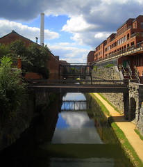
Georgetown Visitors Center (1057 Thomas Jefferson St.; mile 0). The beginning of the canal can be reached off Thomas Jefferson St., south of M St. in Georgetown. It's about a mile walk from Dupont Circle Metro and a little less from Foggy Bottom. There are also shuttle buses from Dupont, Foggy Bottom, and Rosslyn. At the headquarters here you can pick up park maps and occasionally ride on a barge in the canal, led by an interpreter in period costume. (202-653-5190) This is definitely not the most scenic part of the canal, but it's much quieter than M St.

34th Street (about mile 0.4). The western end of Georgetown is another option for entering the canal. From the south end of 34th St., you'll cross a pedestrian bridge over the canal to reach the path. Turn right, and once you cross under the Key Bridge and the Whitehurst Freeway, you'll be in the woods. You can follow either the paved Capitol Crescent Trail, or the packed dirt towpath. Numerous buses serve M St. from different directions; enter your address with a destination of 3400 M St. NW into WMATA and see what you come up with.

Fletcher's Boat House (4940 Canal Rd; mile 3.1). This concession rents not only boats but also bikes; they also sell bait and tackle. The D3 and D6 buses stop at the intersetion of MacArthur Blvd. and Reservoir Rd., about half a mile away; you can catch one at Dupont Circle or Metro Center.

Capital Crescent Bridge (about mile 3.6). Up until this point, the towpath and the Capital Crescent Trail have been on the same side of the canal (the Potomac side). Near the intersection of Arizona Ave. and Canal Rd., the Capital Crescent Trail crosses back over the canal and goes its own way. You can use this as another access to the towpath. The same D3 & D6 buses that stop near Fletcher's Boat House stop at the intersection of Arizona and MacArthur Blvd. It's about .3 miles to the canal; follow Arizona Ave. south.

That should get you started. Is anyone aware of good car-free access points further out? Leave a comment.

Dogs: "
Dogs are welcome throughout the park, however it is important that they are kept on leashes to ensure the safety and comfort of all of our visitors and to protect the park’s flora and fauna. Dog owners are also expected to collect and remove their pets’ waste."

Bikes:
Absolutely. But the towpath isn't paved, and can be rough in spots; you want something more rugged than a road bike. Bikes can be stashed on the front of any Metrobus; you can take your bike on Metro anytime on the weekend, and anytime except 7-10am and 4-7pm during the week.

Tuesday, May 12, 2009

Car-free DC: Rock Creek Park

This is the second article in a series on hikes in DC that can be reached by public transportation.

Rock Creek Park is a treasure. Especially on the weekend, when Beach drive is closed, it is fairly easy to reach places in the woods where you'd have no idea you were in the city. But most DC residents have barely scratched its surface. And so, we bring you ten points of entry to this 1,754 acre park in the heart of the city. We suggest a couple of our favorite circuit hikes below; you can follow along -- or come up with your own routes -- using this park map.

North to south (downstream):

  1. Boundary Bridge – Riley Spring Bridge loop: The hike that includes these two bridges, using the Valley Trail in one direction and the Western Ridge Trail in the other direction, is one of our favorites. You have two options for accessing this loop by public transit. To come in from the Valley Trail side, take one of the S buses that runs along 16th St. and get off at Juniper St. or Holly St. Alternatively, you can enter from the north: it's about three quarters of a mile from a bus stop on East-West Highway to Boundary Bridge. Take the J2 or J3 buses, which run from Silver Spring Metro to Bethesda Metro and stop at Jones Mill Road/Beach Drive, or Ride On Bus # 1, which runs between Silver Spring and Friendship Heights.
  2. Pinehurst Branch: The Pinehurst Branch is another favorite trail of ours; it follows a tributary of Rock Creek. The S bus Whittier St. stop on 16th St. is the closest we know of. There are several good trails going both south and north from here, leading to possibilities for one-way hikes between Whittier St. and points further north on 16th St., or the Nature Center.
  3. Nature Center: it's not huge, but they've got maps and other info and displays to help orient you to the park. Rangers also lead activities from here, and you can access several trails. The E2/3/4 buses stop at the intersection of Military Rd. and 27th St., on their run between Friendship Heights and Fort Totten.
  4. Soapstone Valley: This area was named "Best Place in Rock Creek Park You’ve Never Been To" in the City Paper's Best of DC 2008. Native Americans quarried several rock deposits in the area for tool supplies. You'll follow a small stream down to where it meets Rock Creek. From Van Ness Metro, you can find trailheads on either Yuma or Albemarle St.
  5. Carter Barron: another stop on the 16th St. S bus. We usually walk down Morrow Dr. to the park police station, where you can pick up the Valley Trail. Be forwarned, though, that there's no walking path on Morrow Dr. – you'll be on the shoulder.
  6. Peirce Mill: This was an 1820s gristmill whose waterwheel ran off Rock Creek. Nearby, the Art Barn is a carriage house that now serves as an art gallery. You can get there via Soapstone Valley, or come in through the Melvin C. Hazen Park, which is between the Van Ness and Cleveland Park Metro stops (enter between Rodman and Sedgwick on the east side of Connecticut Ave.)
  7. Piney Branch Parkway: Matt always wows groups with this route into the park. People can't believe how quickly you can reach tranquility from the bustle of the city. From Columbia Heights Metro, take Irving St. west, then take Mt. Pleasant St. north, jog left on Park Dr., then right again to continue north on Mt. Pleasant. The road dead-ends at a trailhead that will put you onto the trail that follows the Piney Branch Parkway.
  8. The Zoo: As you can see on the map, the National Zoo is not part of Rock Creek Park, but it's nestled right in there. From Woodley Park metro, one option is to go through the zoo and pick up the trail that follows the creek on the backside, near the kids' farm area. Alternatively you can go down the big hill along 24th St. as it heads down into the park. The stretch of park south of here has an exercise circuit with various stations. Note how narrow the park is getting down here – the trails continue along the creek, but you're right next to the Parkway – and unlike Beach Drive, it doesn't close down on weekends.
  9. P Street: Another access point to the stretch of the park south of Woodley Park, an easy walk from the Dupont Circle metro. Make sure you go down on the side of the Parkway that you want to be on, because there's too much traffic to cross easily (or safely). It's still pretty despite the cars, though.
  10. Thompson Boat Center: perched at the confluence of Rock Creek and the Potomac, the last stop in Rock Creek Park gives you a chance to explore in another way. The boat center offers boat rentals and lessons. It's about a half mile from Foggy Bottom Metro: go west on I St., left on New Hampshire, then right on Virginia, where you'll walk past the Watergate and then across the Parkway into the boat center. If the Red Line is more convenient, you can also get off at Farragut North and catch the 80 bus toward the Kennedy Center, getting off at New Hampshire and Virginia.


Other info:

Dogs: Dogs are welcome, but are supposed to be on-leash. And, of course, scoop your poop!

Bikes: Allowed on the trails marked as solid grey lines on the park map. In addition, large sections of Beach Drive are closed to cars on weekends (marked in yellow on the park map). Bikes can be stashed on the front of any Metrobus; you can take your bike on Metro anytime on the weekend, and anytime except 7-10am and 4-7pm during the week.

Do you have other tips on accessing Rock Creek? Have you visited recently? Leave a comment and let us know.

Tuesday, May 5, 2009

Car-free DC: National Arboretum

This article is first in a series on hikes in DC that can be reached by public transportation.

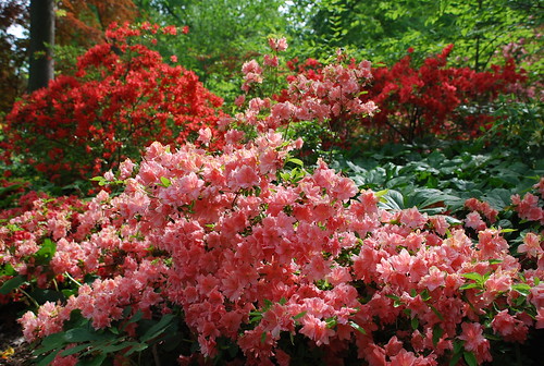
It's azalea time in DC, and nowhere are there more azaleas than at the National Arboretum. Thousands of them, arrayed on a hillside laced with trails for you to explore. What's more, at 240 feet above sea level, "Mount" Hamilton is one of the highest points around, and will reward a small climb with a view of the Capitol.

This year, the arboretum reported the blooms had reached peak on April 30. But there are at least some blooms for weeks on either side of the peak. Follow the azalea "blossom watch" here.

During peak azalea season, there will be crowds. To avoid them, the Arboretum recommends visiting during the week or in the early morning. Crowds also mean lots of cars and parking hassles. This is the perfect situation to inaugurate a series we're calling Car-free DC.

Besides the azaleas, there are lots of good reasons to visit the Arboretum. From the azalea area, you'll see an open field with what looks like the ruins of a Greek temple – it's actually a fun re-purposing of columns that were removed from the Capitol building in a 1958 addition.

Past the columns, you'll come to Fern Valley – the Arboretum's native plant collection and our favorite spot in the park. This is an excellent place to learn the names of plants that you'll see in the woods around DC – many are clearly labeled. Or you can just relax in the shade by the stream and enjoy the lack of azalea-gawkers. There's also a meadow planted with native prairie plants that will show off later in summer – asters, goldenrod, coneflowers, and the butterflies and other pollinators that visit them.

And there's much more: a bonsai collection, a youth garden where local kids have their own plots, a grove consisting of the official trees of every state, waterfront along the Anacostia River…and more. Check out this map of the grounds and this list of what's blooming.

To get to the National Arboretum by public transport:
  • Take Metro to the Stadium Armory Station on the Blue and Orange lines.
  • Take the B2 bus northbound (toward Mount Rainer). If you're unsure where to get off, tell the driver when you board that you want to go to the Arboretum; most drivers will be happy to help you out.
  • You'll get off the bus on Bladensburg Road at Rand Street, just past the Arboretum sign on the right.
  • Walk back to the sign, which is at R Street, and walk down R Street 2 blocks to the Arboretum entrance.

The bus runs every 20 minutes or so on Saturdays and every 25 minutes on Sundays, so you may want to look up when you should leave your local metro station to catch one with a reasonable wait, and take a schedule with you to know when you should aim to catch your ride home. (Of course, that assumes that Metro buses run on schedule, which we know they don't. But still, you can try.)

There's no charge for the Arboretum. The grounds are open 8-5 throughout the year except Christmas Day. The Visitor's Center and bonsai collection are closed for several holidays, and sometimes close early – check the website or give a call.

More info:

Dogs:
"
must be leashed at all times and must be controlled so that they do not urinate on, defecate in, or enter garden beds. Owners must clean up after their pets. Pets are not allowed in the Administration Building or in the National Bonsai and Penjing Museum."

Bikes: There are nine miles worth of roads you can ride on, and the speed limit is 20 mph. There are bike racks at each parking area in the Arboretum.

United States National Arboretum
3501 New York Avenue, NE
Washington, DC 20002-1958
202-245-2726


Bookmark and Share